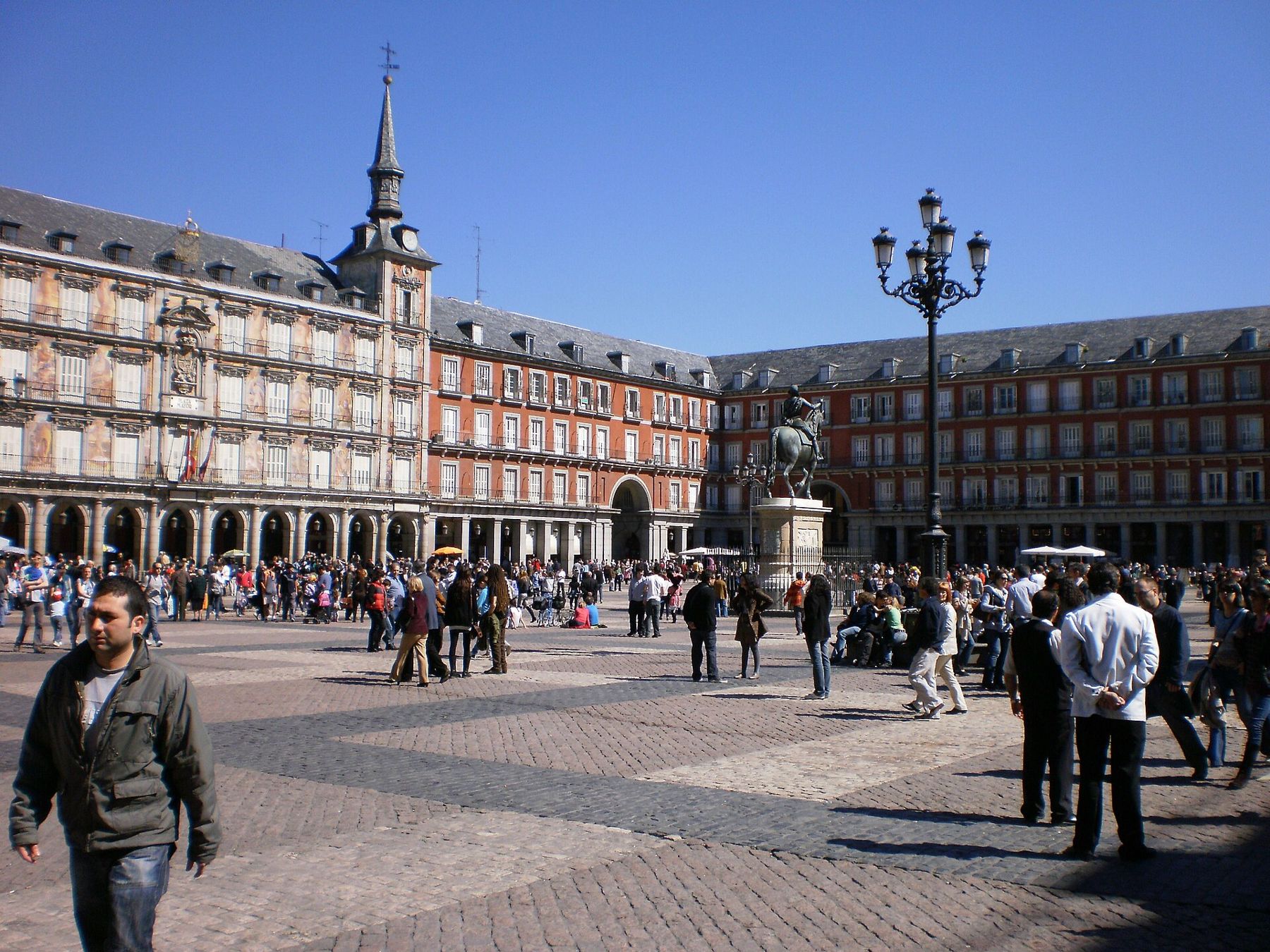
Madrid was a small town on a bluff above the Manzanares until 1561, when Philip II made it the seat of his court. The Habsburgs, called the Austrias in Spain, ruled from here until 1700, and the streets between Puerta del Sol and the palace still follow the town they knew: crooked lanes, small squares and the great arcaded Plaza Mayor they built for ceremonies.
This walk crosses that old core from east to west. It starts at the kilometre zero plaque in Puerta del Sol, passes through the Plaza Mayor and the Plaza de la Villa, then follows the line of the bluff to the Almudena cathedral and the remains of the ninth-century Moorish wall. It ends in front of the Royal Palace and in the formal gardens beside it. The route is about two kilometres with gentle slopes, and takes around two hours at a looking pace. The cathedral and palace keep their own hours and charge for some areas; check on the day.
Sol metro station, on lines 1, 2 and 3, opens right onto the square.
Puerta del Sol, Kilómetro Cero
Look down at the stone plaque marking kilometre zero in front of the clock building.
The plaque on the pavement marks the point from which Spain's national roads are measured, and the building behind it explains why. The Real Casa de Correos was built in the eighteenth century as the main post office; it now houses the regional government of Madrid. On New Year's Eve, crowds fill the square and the country watches the clock on its tower on television, eating a grape on each of the twelve chimes of midnight.
The square was named after a city gate that once stood here and has long been where Madrid gathers. On 2 May 1808 it saw some of the fiercest street fighting of the uprising against Napoleon's troops. On the east side, find the bronze bear reaching up into a strawberry tree, the emblem of the city's coat of arms and the most common meeting point in Madrid.
Walk on · West along Calle Mayor, then left through an arch into the square, 5 minutes.
Plaza Mayor
Look at the painted façade of the Casa de la Panadería on the north side.
Philip III had the square built to a design by Juan Gómez de Mora, and it was completed in 1619. It was the stage of Habsburg Madrid: markets, bullfights, royal proclamations, canonisations and the public trials of the Inquisition were all held here, watched from the balconies. Fires repeatedly damaged it, and after the great fire of 1790 Juan de Villanueva rebuilt it, closing the corners with arches so that it became the enclosed square you see.
The Casa de la Panadería, once the bakers' guild house, has had its façade painted with mythological figures since 1992. The equestrian statue of Philip III in the centre was begun by Giambologna and finished by Pietro Tacca, and was moved here in the nineteenth century. Before you leave, look down the steps of the Arco de Cuchilleros in the south-west corner to see how high the square sits above the streets below.
Walk on · Out by the north-west corner to Calle Mayor, then left to the small square, 5 minutes.
Plaza de la Villa
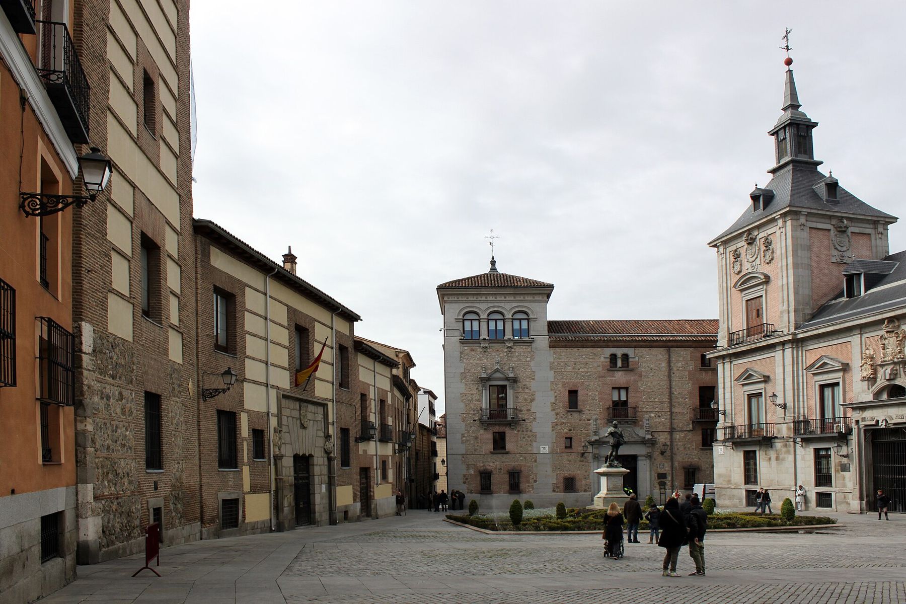
Look at the brick tower with the pointed stone doorway on the east side.
This small square was the centre of civic Madrid for centuries. The Torre de los Lujanes, with its Gothic doorway, dates from the fifteenth century and is one of the oldest buildings in the city. Tradition holds that King Francis of France was held here after his capture at the battle of Pavia in 1525, though historians doubt it. Facing it is the Casa de la Villa, built in the seventeenth century as the town hall, which served the council until it moved to the Cibeles palace in the 2000s. On the south side is the Casa de Cisneros, from the sixteenth century.
The statue in the garden is Álvaro de Bazán, the admiral who fought at Lepanto in 1571, made by Mariano Benlliure. Notice how three centuries of building, from Gothic to Renaissance to baroque, face each other across a few metres of paving.  Change here for the Lisbon lineBaixa and the river front
Walk on · West along Calle Mayor to Calle de Bailén, then left to the cathedral, 6 minutes.
Catedral de la Almudena
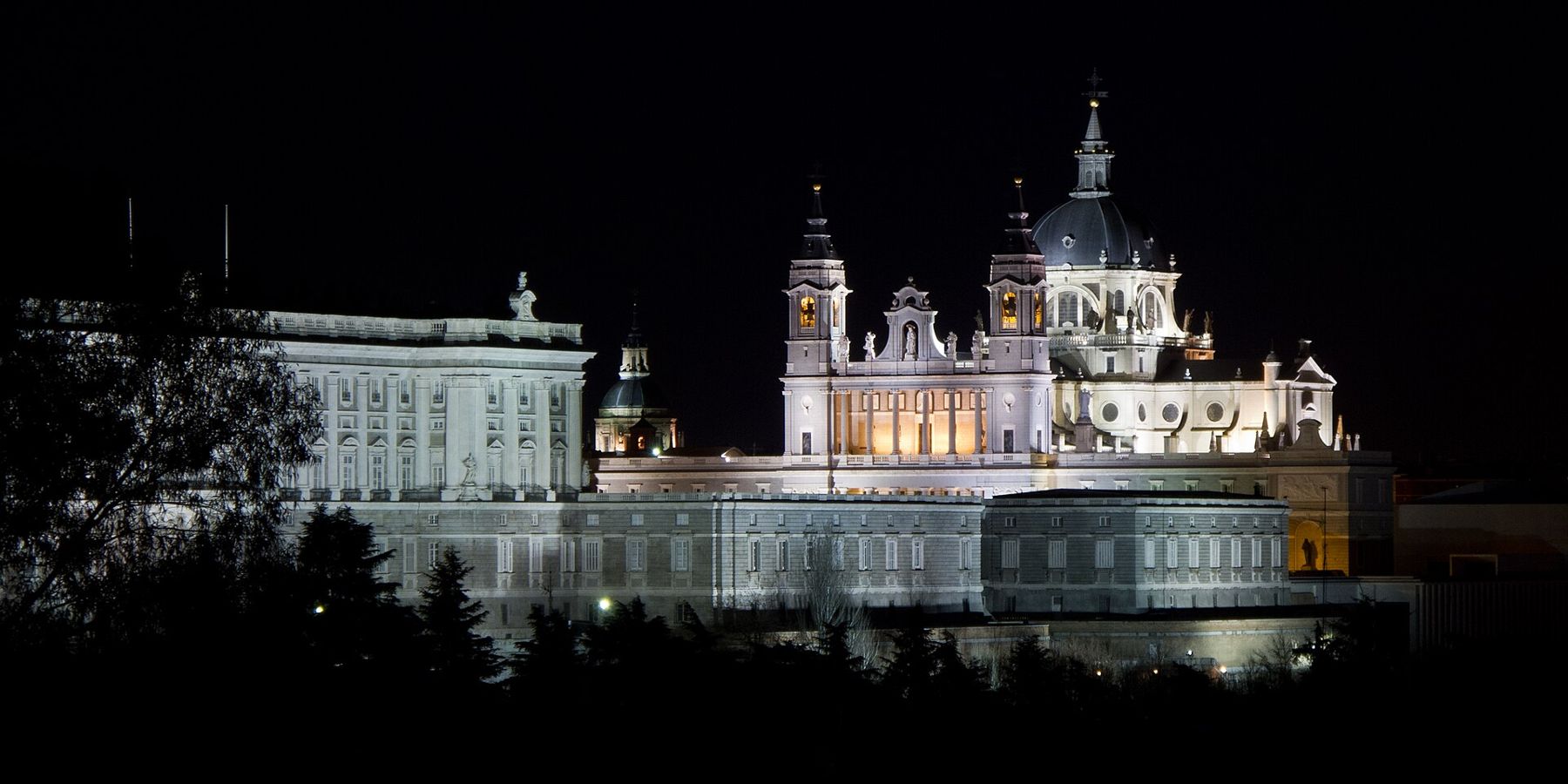
Look at the dome and the classical front facing the palace across the open square.
For centuries Madrid was a capital without a cathedral, because it belonged to the diocese of Toledo. When Madrid got its own bishop in 1885, a cathedral was already under way: the first stone was laid in 1883. Work stopped and started for more than a century, through changes of plan and the Civil War, and the building was only consecrated in 1993, by Pope John Paul II.
The result mixes styles: a neo-Romanesque crypt, a neo-Gothic interior and a classical exterior designed to match the palace opposite. The name comes from the Virgin of the Almudena, an image said to have been found hidden in the old wall after the Christian conquest; the word comes from the Arabic for the citadel. On Calle Mayor, on your way here, a small memorial marks where a bomb was thrown at the wedding procession of Alfonso XIII in 1906.
Walk on · Down the slope of Cuesta de la Vega, along the cathedral's south side, 2 minutes.
Muralla árabe (Parque Emir Mohamed I)
Look at the rough stretch of flint and limestone wall below the street.
This is where Madrid began. In the ninth century the emir of Córdoba, Muhammad, built a fortress on this bluff above the Manzanares to watch the routes towards Toledo, and called it Mayrit. The stretch of wall in the small park below the cathedral is the largest surviving piece of that first fortified town, built from blocks of flint and limestone.
Christian Castile took the town in the eleventh century, and later walls pushed the city outward, but the line of the first wall is still followed by some of the streets around here. Look at how steeply the ground falls away to the west: the river valley and the green of the Casa de Campo beyond show why the site was chosen. It is easy to walk straight past; few visitors stop.
Walk on · Back up past the cathedral and north along Calle de Bailén to the palace square, 7 minutes.
Plaza de Oriente and the Palacio Real
Look at the rearing bronze horse of Philip IV in the centre of the gardens.
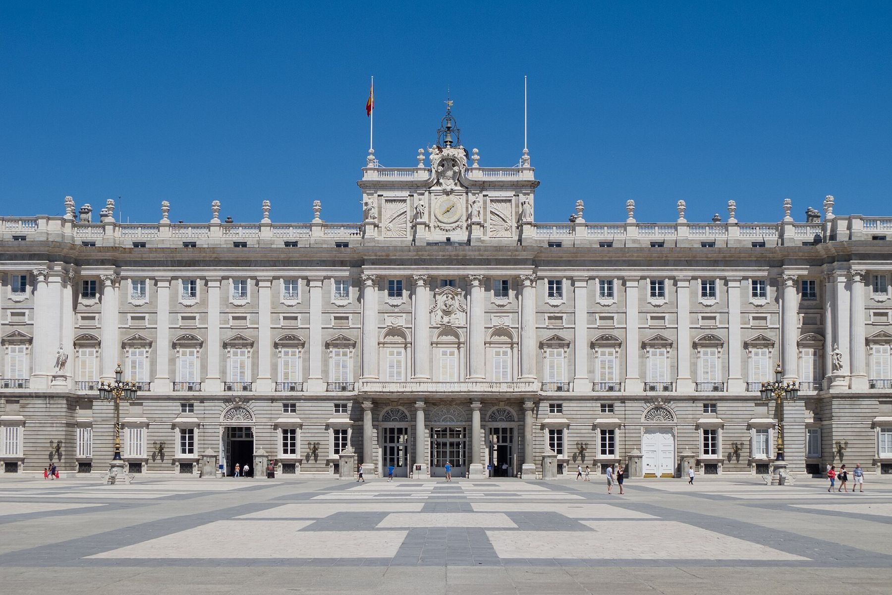
The old Habsburg fortress-palace, the Alcázar, burned down on Christmas Eve 1734. The Bourbon Philip V ordered a new palace in stone, designed by Filippo Juvarra and then Giovanni Battista Sacchetti, and Charles III was the first king to live in it, from 1764. It is still the official residence of the Spanish king, though the royal family lives elsewhere and uses it for state ceremonies; parts are open to visitors, with hours and prices that change.
The square on its east side was cleared in the nineteenth century. The statue of Philip IV, cast by Pietro Tacca around 1640, was one of the first large equestrian statues with the horse rearing on its hind legs; the balance is said to have been worked out with advice from Galileo. Along the gardens stand stone kings of Spain, made for the palace roof but taken down soon after. On the far side of the gardens is the Teatro Real, the opera house.
Walk on · North along Calle de Bailén, keeping the palace on your left, to the gardens, 4 minutes.
Jardines de Sabatini
Look along the clipped hedges and the long pool towards the palace's north front.
These formal gardens occupy the site of the royal stables, which were designed by Francesco Sabatini, the Italian architect who also built the Puerta de Alcalá. The stables were demolished in the 1930s and the gardens laid out in their place in a neoclassical style, with box hedges, pools and rows of statues. They were opened to the public in 1978.
Walk to the far end and turn round for the best view of the palace's north side, rising high above the gardens on its bluff. From the upper terrace on the west, you look down into the valley of the Manzanares, now the riverside park of the Madrid Río walk. This is a good place to end in late afternoon, when the stone turns warm and the benches fill up.
Finishing at the palace gardens
The walk ends in the Sabatini gardens, on Calle de Bailén. Plaza de España is a five-minute walk north, and the Templo de Debod, the sunset finish of the Malasaña and Conde Duque walk, lies just beyond it. Ópera metro station, on lines 2 and 5, is behind the Plaza de Oriente.
Heat, water and toilets
Madrid summers are hot and dry, and the stretch past the cathedral and the palace is wide open to the sun, with little shade until the gardens. Start early from June to September and carry water; the city's public drinking fountains are common in squares and parks. There are few public toilets on the route; the cathedral and the palace have their own for visitors.
Crowds and safety
Puerta del Sol and the Plaza Mayor are among the most crowded spots in Spain and attract pickpockets: keep bags closed and phones out of back pockets. The steps of the Arco de Cuchilleros are uneven. For more of old Madrid, the Barrio de las Letras walk starts a few minutes east of Sol.