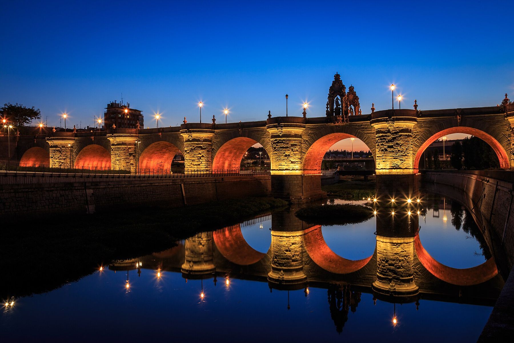
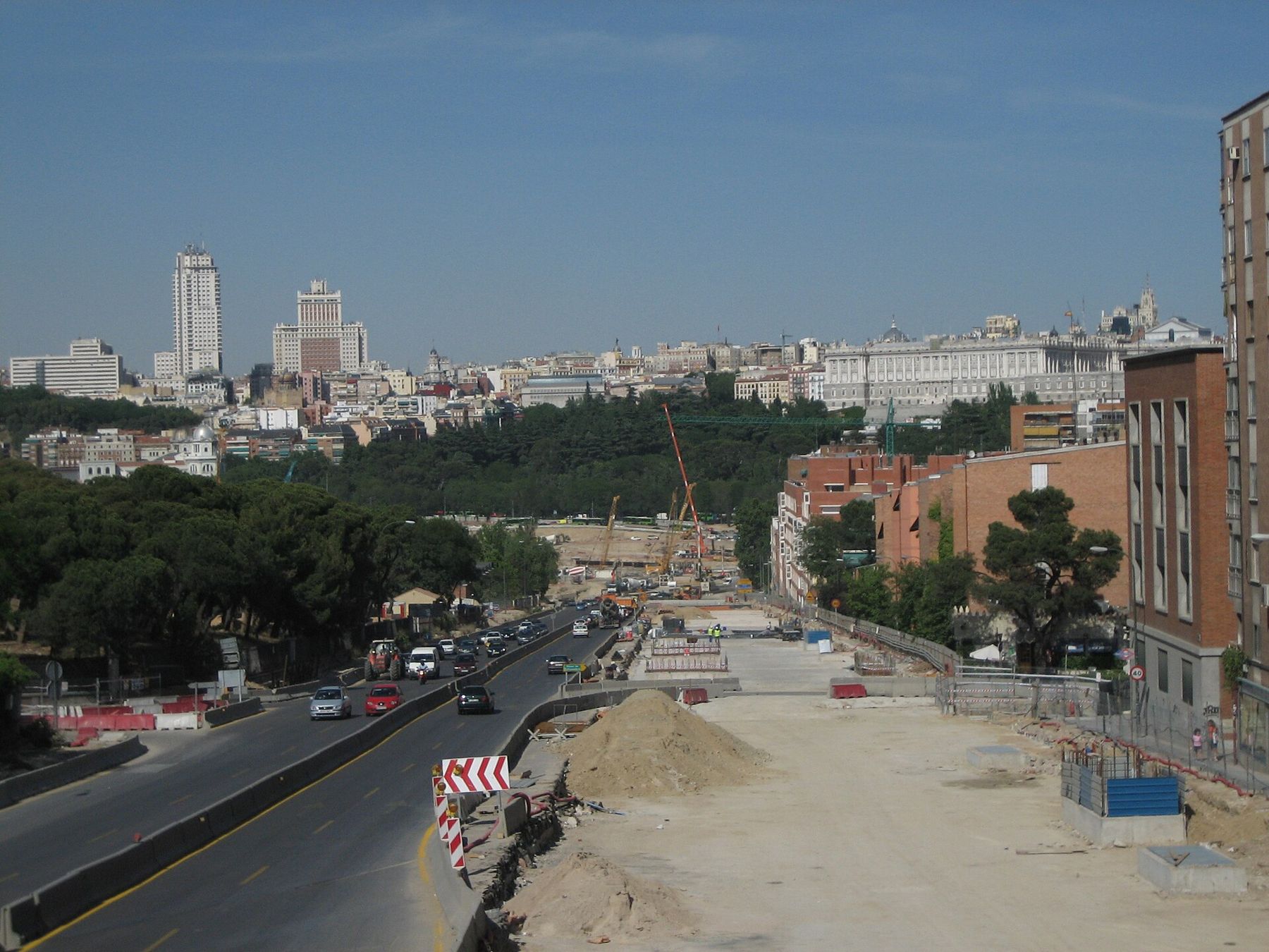
For decades the Manzanares, the modest river below the Royal Palace, ran beside one of the busiest roads in the city, the M-30 ring road. In the 2000s the city buried this stretch of the motorway in tunnels and built a park on top. Madrid Río, opened in stages from the late 2000s, now runs for several kilometres along both banks, with paths, playgrounds, gardens and new footbridges between the old stone ones.
This walk follows the river south from the Puente del Rey, near Príncipe Pío station, past the oldest bridge in Madrid, the Puente de Segovia, along a promenade of pines to the baroque Puente de Toledo. It ends at the new footbridges near the Matadero, a former slaughterhouse now used as an arts centre. The route is flat, about four kilometres, and takes about two hours at an easy pace.
Príncipe Pío station, served by metro lines 6, 10 and the R shuttle and by suburban trains, is two minutes from the start. Legazpi metro, on lines 3 and 6, is near the end.
Puente del Rey
Look along the bridge towards the trees of the Casa de Campo on the far bank.
The Puente del Rey, the king's bridge, was built in the early nineteenth century to link the Royal Palace with the Casa de Campo, the royal hunting estate across the river, which was opened to the public as a park in 1931. Today the bridge is for pedestrians and cyclists, and it is one of the main gateways into the Madrid Río park.
Stand on the bridge and look downstream. The river is narrow and controlled by a series of weirs, which keep the water at a steady level. Writers of the golden age made fun of the Manzanares for being too small for such a grand city. Behind you, uphill, are the palace and the cathedral on their bluff, the end of the Madrid de los Austrias walk. Look at the fountains and paddling pools nearby, popular in summer.
Walk on · South along the east bank path, with the river on your right, 8 minutes.
Puente de Segovia
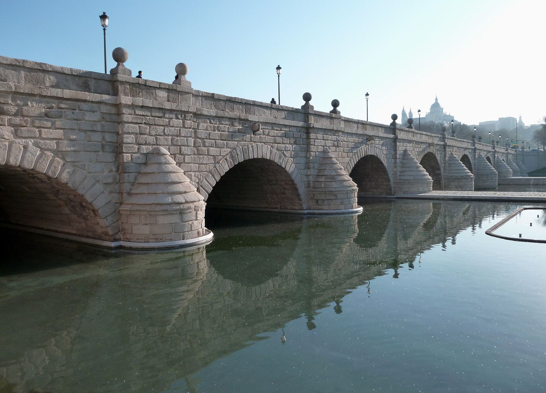
Look at the nine granite arches and the rounded cutwaters between them.
The Puente de Segovia is the oldest bridge in Madrid, built in the 1580s under Philip II and attributed to Juan de Herrera, the architect of El Escorial. It carried the road to Segovia out of the city, and its massive granite arches were built for floods that the river rarely produced, which only added to the jokes about the Manzanares.
The bridge was damaged in the Civil War, when the front line ran along the river here, and was later restored. Walk down to the water's edge on the east bank to see the arches reflected in the river. Upstream you can see the Almudena cathedral and the Royal Palace on the skyline; this is the view that painters used to show Madrid rising from its river.
Walk on · Cross the bridge and follow the west bank south through the pines, 7 minutes.
Salón de Pinos
Look along the long avenue of pines stretching south beside the river.
The Salón de Pinos is a long promenade of pine trees planted along the west bank of the river as part of the park. It is one of the main features of Madrid Río: a line of shade running for several kilometres, with paths for walking and cycling, benches and playgrounds. The pines are now tall enough to give real shade.
Beneath your feet, under the park, run the tunnels of the M-30 ring road. Notice the ventilation stacks and the service buildings, some disguised among the trees. Look across the river at the old working-class neighbourhoods of the east bank, which were cut off from the river by the motorway for decades.  Change here for the Lisbon lineBaixa and the river front
Walk on · Continue south along the Salón de Pinos to the baroque bridge, 12 minutes.
Puente de Toledo
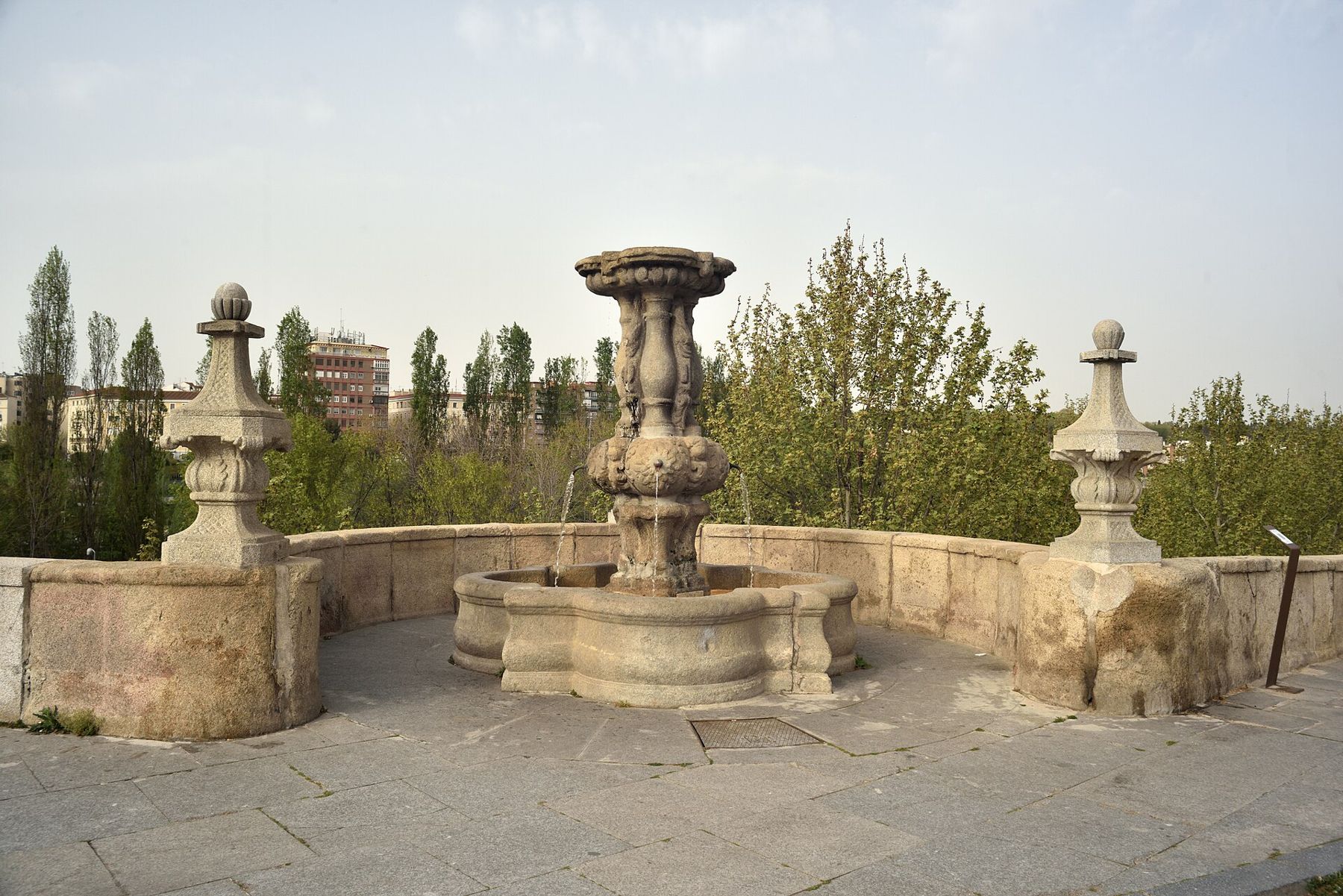
Look at the carved stone shrines on the bridge, each with a saint inside.
The Puente de Toledo was built in the early eighteenth century, to designs by Pedro de Ribera, the city architect whose doorways you can see at the history museum and the Conde Duque barracks. It replaced earlier bridges washed away by floods, and carried the road south to Toledo.
It is a baroque bridge, with two shrines in the middle, holding statues of Madrid's patron saint, Isidro the labourer, and his wife, María de la Cabeza. Today it is for pedestrians only. Walk out to the middle to look at the statues and the carved stone, and look over the side at the river and the gardens. At dusk the arches are lit, and their reflections double them in the water.
Walk on · South-east along the river path past the Arganzuela park, 15 minutes.
Puente de Arganzuela
Look at the steel spiral of the footbridge twisting over the river.
The Puente de Arganzuela was designed by the French architect Dominique Perrault and opened in 2011. It is a footbridge in two parts, made of steel strips wound in a spiral like a coiled spring, so that walking across it feels like passing through a tube. It links the Arganzuela park on the east bank with the neighbourhoods on the west.
The park around it has playgrounds, open lawns and water features, and is busy with families at weekends. Walk across the bridge and back to see how the light falls through the steel strips. Notice too how far the river is from the old city now: you have walked from below the palace almost to the southern edge of central Madrid.
Walk on · Downstream along the east bank to the twin concrete footbridges, 6 minutes.
Puentes Cáscara (Matadero footbridges)
Look up at the mosaic faces on the underside of the shell-shaped bridge.
Two twin footbridges cross the river near the Matadero, built as thin concrete shells, so they are known as the shell bridges. On the underside of each vault is a large mosaic by the artist Daniel Canogar, with figures modelled on people from the neighbourhood.
The mosaics are only visible from below, as you walk across the bridge or along the bank, which makes them a surprise. Stand under the vault and look up. The bridges are part of a series of new crossings built for Madrid Río to stitch together the two banks, divided for decades by the motorway.
Walk on · Across the bridge and into the Matadero grounds, 4 minutes.
Matadero Madrid
Look at the neo-Mudéjar brick pavilions with their tiled decoration.
The Matadero was the city's slaughterhouse and livestock market, built in the early twentieth century to designs by the architect Luis Bellido. The pavilions are in neo-Mudéjar style, brick with ceramic tile decoration, recalling the brickwork of Moorish Spain. The slaughterhouse closed in the 1990s, and since the 2000s the city has turned it into an arts centre, with theatres, exhibition halls, a cinema and workshops.
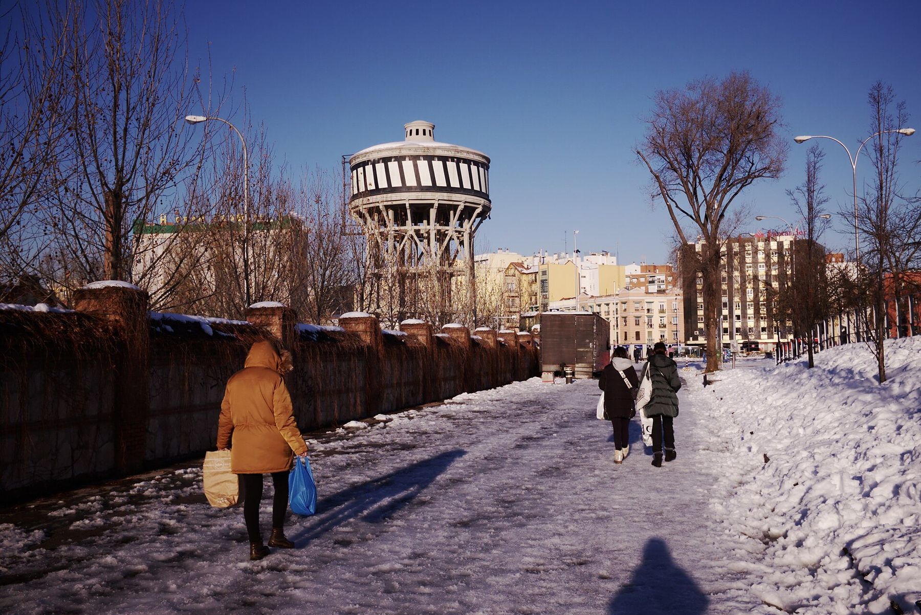
The open spaces between the pavilions are public, and you can walk through freely. Notice the old water tower rising above the walls, and the way each pavilion was built for a different stage of the trade. The programme and opening hours change, so look at what is on.
Finishing at Matadero
The walk ends in the Matadero, on the Paseo de la Chopera. Legazpi metro, on lines 3 and 6, is a few minutes south-east in the Plaza de Legazpi. If you still have energy, the park continues south along the river for several more kilometres.
Shade, water and bikes
The Salón de Pinos gives good shade on the west bank, but much of the rest is open, and Madrid summers are hot: walk in the morning or after the heat of the day, and carry water. There are drinking fountains and public toilets along the park, and the fountains near the Puente del Rey are popular with children in summer. Cyclists share the park, so stay on the walking side of shared paths and watch for bikes when you cross.
Next
For the old city above the river, walk the Madrid de los Austrias route, or go north to Malasaña and the Templo de Debod for the sunset on the Malasaña and Conde Duque walk.