Coyoacán was a town in its own right long before Mexico City reached it. Its name comes from Nahuatl and is usually translated as the place of coyotes. After the fall of Tenochtitlan in 1521, Hernán Cortés set up his government here while the capital was rebuilt, and the town kept its own character through the centuries: plazas, a Dominican church, cobbled streets and walled gardens.
This walk starts in the Viveros de Coyoacán, a tree nursery that is also a park, follows Avenida Francisco Sosa east past colonial houses and chapels to the twin squares at the centre, Jardín Centenario and Jardín Hidalgo, then visits the parish church and the market before ending outside the Casa Azul, the house where Frida Kahlo was born and died.
The route is about 3.2 kilometres, flat, and takes a little over two hours. Metro Viveros, on Line 3, is a few minutes' walk from the nursery's western gate on Avenida Universidad.
Weekends bring crowds to the centre, especially Sunday afternoons, so start early. Coyoacán pairs well with nearby San Ángel on the same day.
Viveros de Coyoacán
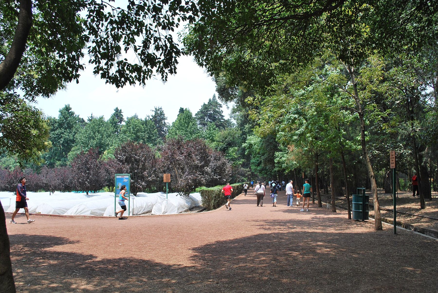
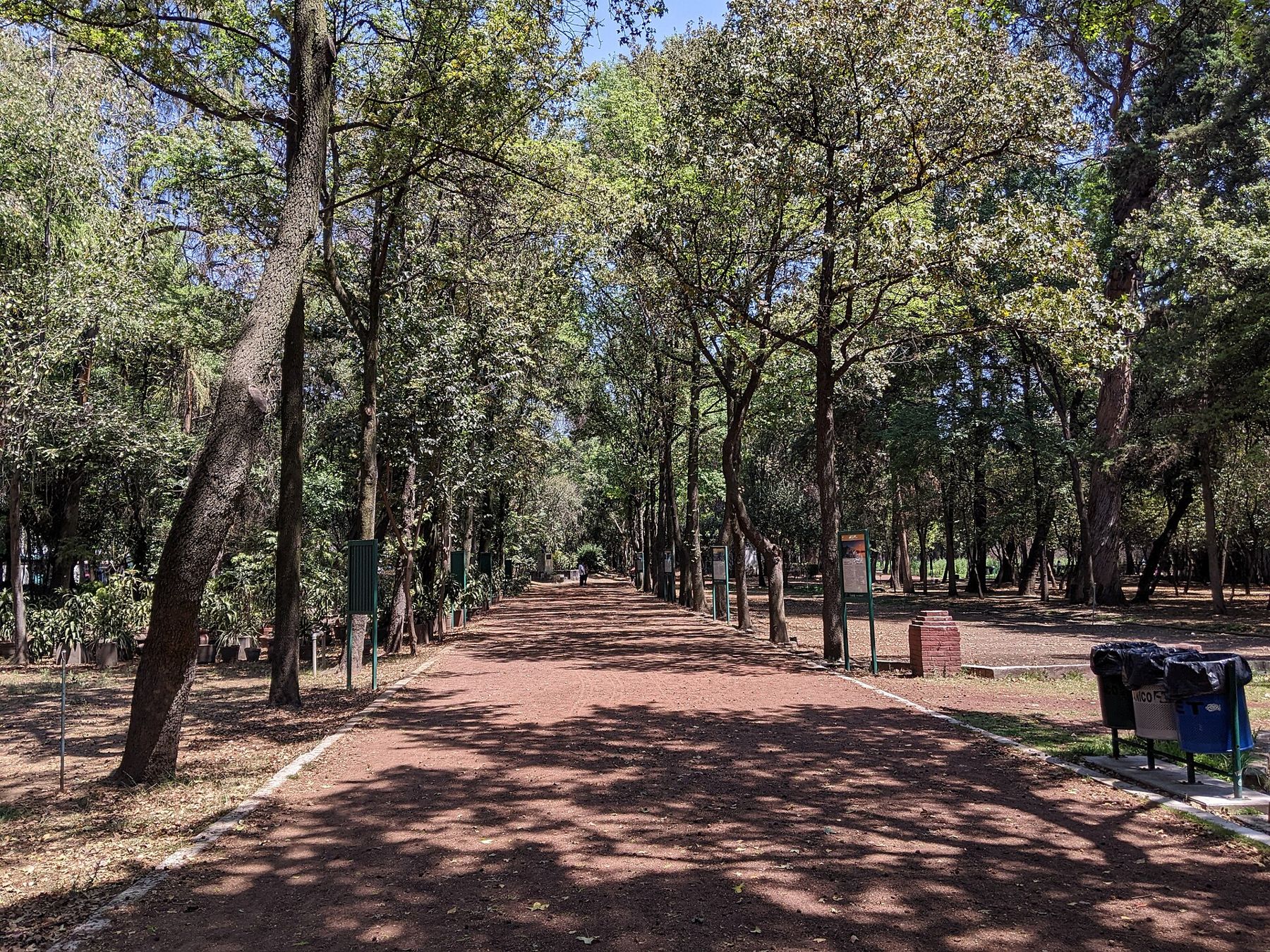
Look along the rows of young trees growing in their nursery beds.
The Viveros de Coyoacán are a working tree nursery as well as a park. They were created in the early twentieth century by the engineer Miguel Ángel de Quevedo, known in Mexico as the apostle of the tree, who used land here to grow saplings for reforesting the valley and planting the city's avenues.
Today runners circle the main path from early morning, and the beds of young trees still fill much of the ground.
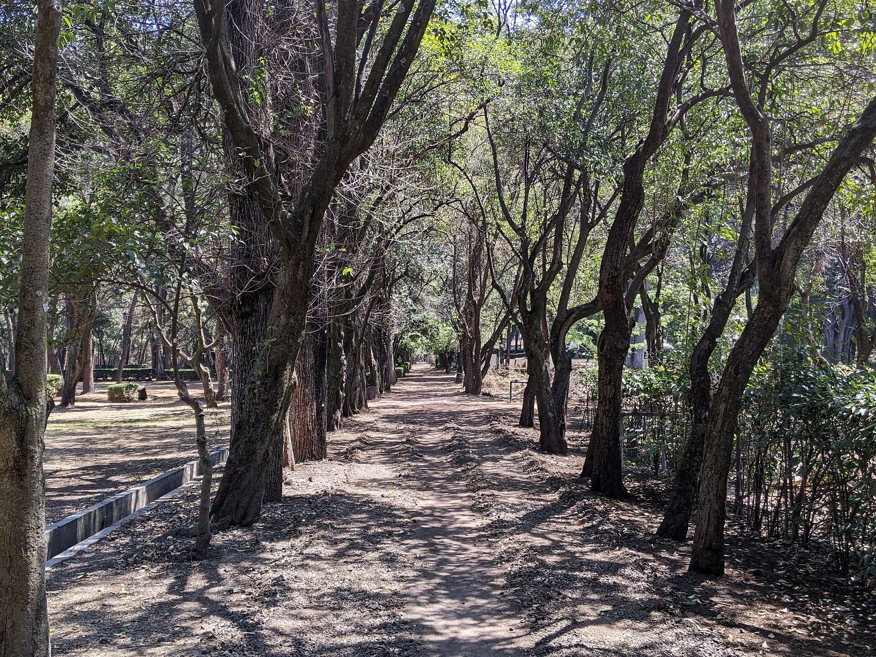
Notice the squirrels, which are bold here and well fed, and the quiet: the traffic of Avenida Universidad disappears within a few steps. The nursery has opening hours; check them before you go.
Walk on · Leave by the south side of the park and walk south to Avenida Francisco Sosa; 10 minutes.
Plaza Santa Catarina
Look at the small yellow chapel facing the tree-lined square.
This small square on Francisco Sosa is one of the oldest corners of Coyoacán, the centre of the old barrio of Santa Catarina. The chapel of Santa Catarina dates from the colonial period and still serves the neighbourhood.
Avenida Francisco Sosa itself, running east from here, is often described as one of the first streets laid out by the Spanish in the Americas, along an older route from Coyoacán toward the west. It is named after a nineteenth-century writer.
Notice the scale: low walls, single-storey houses, trees leaning over garden walls. Even with the city all around, the square keeps the feel of a village green.
Walk on · Walk east along Francisco Sosa; the cobbles and garden walls run all the way. 6 minutes.
Avenida Francisco Sosa
Look along the street at the high garden walls and heavy wooden gates.
Francisco Sosa is a street of colonial and later mansions hidden behind long walls, with glimpses of gardens through gateways. Several now house cultural institutions. One of the oldest, the Casa de Alvarado, is linked by tradition to Pedro de Alvarado, Cortés's captain, and now holds the national sound archive, the Fonoteca Nacional.
The street is busy with walkers and cyclists at weekends, and on weekday mornings it belongs to dog walkers and schoolchildren.
Notice the details of the walls: niches with saints, carved stone coats of arms over gates, and the deep red and ochre colours that Coyoacán favours.
 Change here for the Mexico City lineRoma and Condesa
Walk on · Continue east on Francisco Sosa to the arch at the entrance to the main square; 5 minutes.
Jardín Centenario
Look at the bronze coyotes drinking at the fountain in the middle of the garden.
The Jardín Centenario is the western of Coyoacán's two central squares, and its fountain of two coyotes is the symbol of the district. Its name recalls the centenary of independence, celebrated in 1910.
The stone arches on its eastern side once formed part of the entrance to the atrium of the Dominican church next door.
Notice the life of the square: families, balloon sellers, street musicians and people sitting on the benches. On weekends it fills from midday, and on Sunday afternoons it can be packed. The trees around it are among the oldest in the centre.
Walk on · Pass through the arches toward the church front on the east; 2 minutes.
Parroquia de San Juan Bautista
Look up at the bell tower and the carved stone doorway.
The parish church of San Juan Bautista was built by Dominican friars in the sixteenth century, soon after the conquest, and it has been the religious centre of Coyoacán ever since. The building has been changed and repaired many times, but its stone doorway and the plan of the old atrium survive.
Inside, the church is richly decorated, with gilded altarpieces and painted ceilings. It is a busy parish, with weddings and baptisms on most weekends, so enter quietly and keep to the sides during services.
Notice the old atrium in front of the church, now part of the public squares, where the friars once preached to crowds too large for the nave.
Walk on · Walk north along the church's atrium to the garden of Jardín Hidalgo; 2 minutes.
Jardín Hidalgo and the Casa de Cortés
Look at the arcaded red building closing the north side of the garden.
Jardín Hidalgo is the eastern of the two squares, with a bandstand and a statue of Miguel Hidalgo, the priest who began the war of independence in 1810.
On its north side stands the building known as the Casa de Cortés, the local government headquarters. The present building is from the eighteenth century, but tradition links the site to the house where Cortés governed after the conquest, before he moved to the rebuilt capital.
Notice the coat of arms over the door and, if the building is open, the murals inside about the history of Coyoacán. Sunday brings stalls and performers to the garden.
Walk on · Walk north two blocks along Calle Allende to the market; 5 minutes.
Mercado de Coyoacán
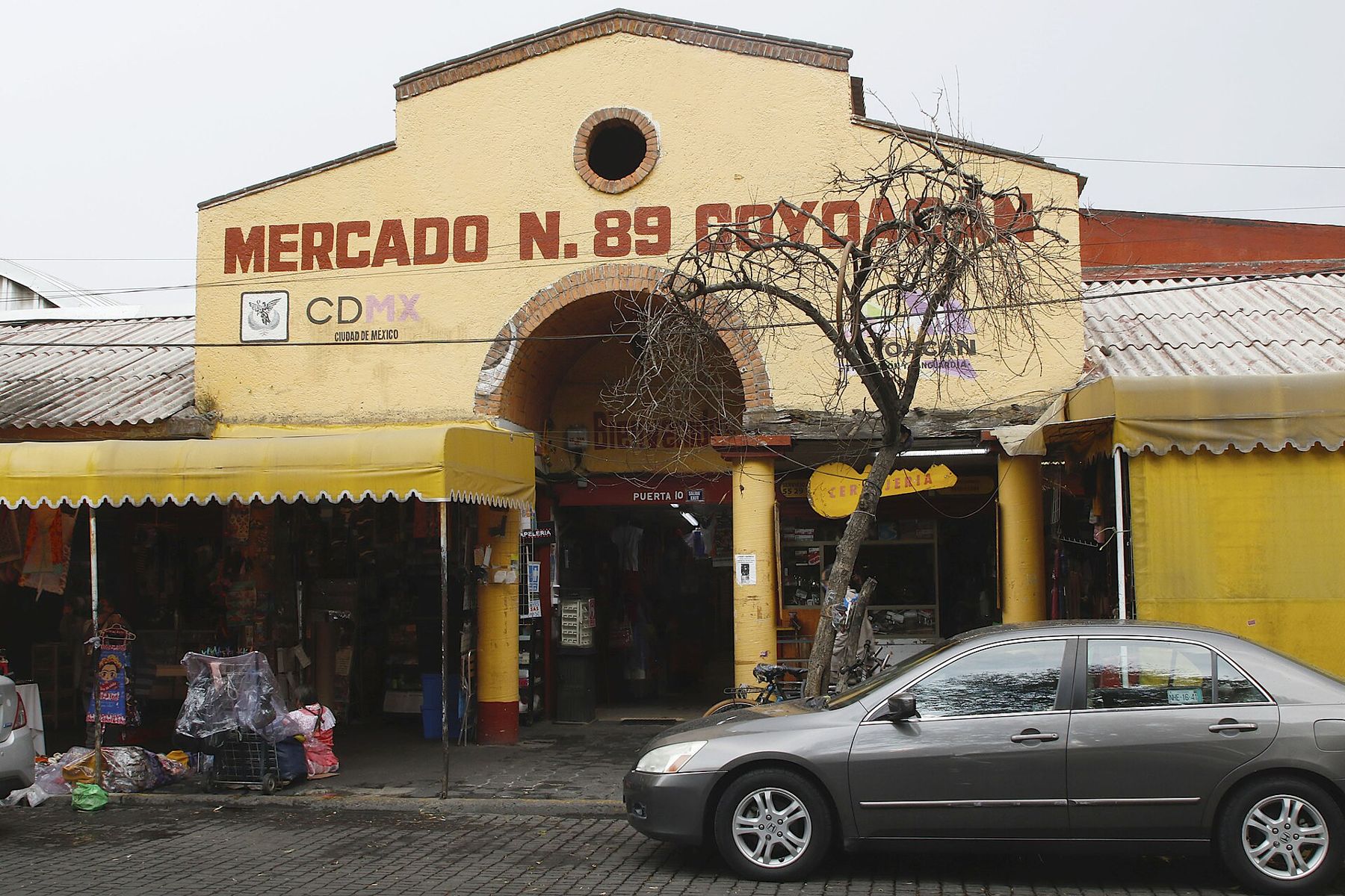
Look at the yellow arched entrance with the market's name across it.
The Mercado de Coyoacán is the neighbourhood's covered public market. Inside, stalls sell fruit and vegetables, meat, flowers, piñatas, toys and household goods, and food counters serve local dishes.
The market is especially known for its tostadas: crisp fried tortillas piled with toppings such as beans, chicken, seafood, cream and salsa. Several counters inside serve them.
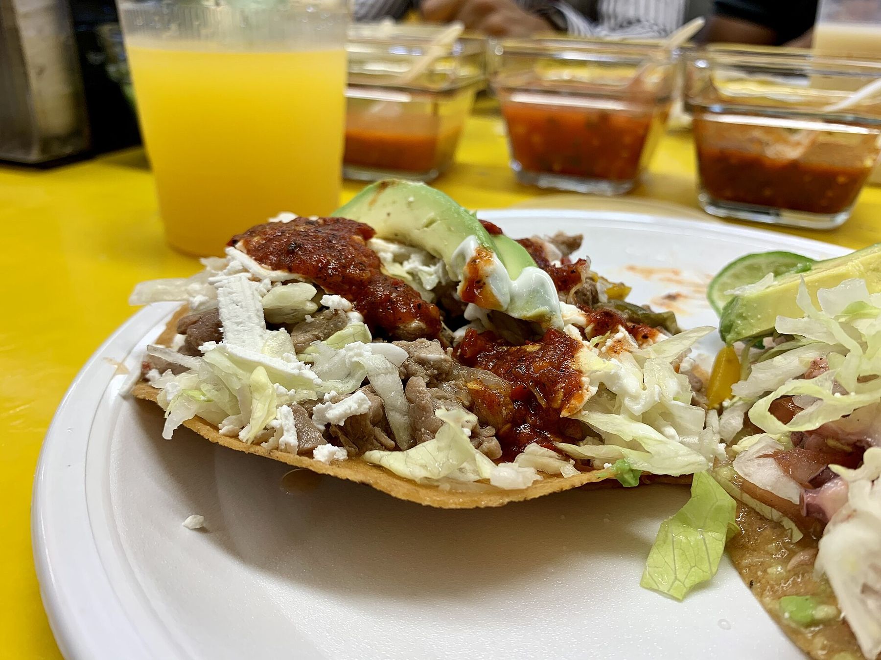
Notice how the market is organised by trade, with each aisle for one kind of goods, and how much of it is aimed at local households rather than visitors.
Walk on · Continue north along Allende for three blocks to the corner with Londres; 5 minutes.
Casa Azul
Look at the cobalt blue walls running the length of the street corner.
The Casa Azul, the Blue House, is where Frida Kahlo was born in 1907 and where she died in 1954. She lived here with Diego Rivera for years, and after her death Rivera gave the house to become a museum, which opened in 1958.
The intense blue of the walls has become one of the best known colours in Mexico. Inside are her studio, her bedroom, her clothes and the garden, but entry is by timed ticket and queues are long; book ahead if you want to go in.
Notice the queue itself, often stretching down the street. A few blocks north-east, on Avenida Río Churubusco, is the house where Leon Trotsky lived in exile and was murdered in 1940, now also a museum.
Where you finish
You end at the corner of Londres and Allende outside the Casa Azul. Metro Coyoacán, on Line 3, is about twenty minutes' walk west, or take a taxi. The Templo Mayor and the cathedral of the Centro Histórico tell the other half of the story of the conquest that began Coyoacán's colonial life.
Shade, water and toilets
The walk is flat and largely shaded, especially in the Viveros and along Francisco Sosa. The cobbles and old paving are uneven, so wear comfortable shoes. The market and some museums have toilets, often for a small fee, so carry coins. Carry water too; the sun is strong in the open squares.
Safety sense
Coyoacán is generally calm, but the centre gets very crowded at weekends. Keep your bag in front and your phone close in the squares and the market. Cyclists use Francisco Sosa, so stay aware when you step off the pavement.