The Centro Histórico is where Mexico City began. The Mexica, the people usually called the Aztecs, founded Tenochtitlan on an island in a lake in the fourteenth century; the Spanish conquered it in 1521 and built their capital on top of it, reusing its stones and its street plan. Walking here, you move between those layers: an excavated temple, a cathedral, viceregal palaces, and the palaces and towers of the twentieth century.
This walk starts in the Zócalo, visits the Palacio Nacional and the Templo Mayor, enters the Metropolitan Cathedral, then follows the pedestrian Calle Madero west past baroque palaces and the Casa de los Azulejos to the Torre Latinoamericana, the Palacio Postal and the Palacio de Bellas Artes.
The route is about 2 kilometres and flat, and takes around two hours without museum visits. The Templo Mayor museum and the murals of the Palacio Nacional each deserve an hour more; opening days, hours and access rules change, so check before you go.
Metro Line 2 stops at the Zócalo itself. Start early: the square is calm in the morning, and the streets fill quickly after ten.
Zócalo
Look at the giant flag on its pole in the middle of the square.
The Zócalo is one of the largest public squares in the world. Its official name is Plaza de la Constitución, after the Spanish liberal constitution of 1812. The nickname means plinth: in the nineteenth century a monument to independence was planned for the centre, only its base was built, and the word stuck to the whole square.
This was also the centre of Tenochtitlan, and around you stand the main powers of the country: the cathedral to the north, the Palacio Nacional to the east, and the city government to the south.
Notice how the square is used: for concerts, protests, festivals, book fairs and the national celebrations of independence. Its emptiness is deliberate, a stage waiting for a crowd.
Walk on · Cross the square east to the long red-stone front of the Palacio Nacional; 4 minutes.
Palacio Nacional
Look at the central balcony and the bell set above it.
The Palacio Nacional fills the whole eastern side of the Zócalo. It stands on the site of the palace of Moctezuma; Hernán Cortés built his own residence here, and it became the seat of the viceroys and later of the presidents of Mexico. It is still the seat of the federal executive.
Inside, on the main staircase and the first-floor corridors, are Diego Rivera's murals of the history of Mexico, painted from 1929 onward: the Aztec world, the conquest, independence and the revolution in one sweep. Entry needs identification and is sometimes suspended.
Notice the bell above the central balcony. Each year on the night of 15 September the president rings it and repeats the cry of independence to the crowd in the square.
Walk on · Walk north along the palace front and past the cathedral's side to the excavations; 5 minutes.
Templo Mayor
Look down into the excavated layers of stone stairways and platforms.
The Templo Mayor was the great temple of Tenochtitlan, a stepped pyramid crowned by twin shrines to Huitzilopochtli, god of war and the sun, and Tláloc, god of rain. It was enlarged again and again, each new temple built over the last, so the ruins are a set of nested layers.
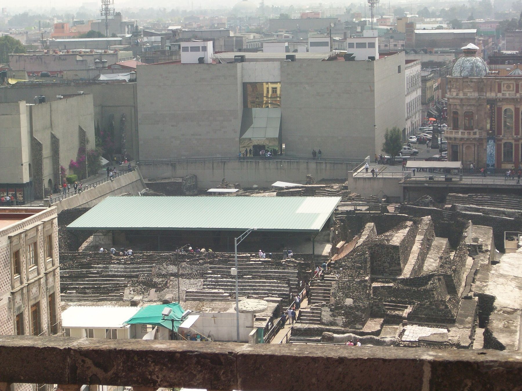
After the conquest it was demolished and built over. In 1978 electricity workers digging here found a huge carved stone disc of the goddess Coyolxauhqui, and the excavations that followed uncovered the temple. They continue, and the site museum holds the finds.
Notice the serpent heads at the foot of some stairways, and how far below today's street the oldest layers lie.
Walk on · Walk back south to the cathedral's main doors facing the Zócalo; 3 minutes.
Catedral Metropolitana
Look at the two bell towers and the clock above the main front.
The Metropolitan Cathedral took about two and a half centuries to build, from the 1570s to 1813, and its front mixes the styles of that long span, from Renaissance and baroque to neoclassical. Inside, the gilded Altar de los Reyes rises behind the main altar.
Beside it stands the Sagrario Metropolitano, the parish church, with an eighteenth-century front carved in dense, deep relief.
The whole building sits on the soft clay of the old lake, and it has sunk unevenly for centuries. Engineering work in the 1990s stabilised it. Inside, look for the long plumb line hanging in the nave: the point where it should touch the floor shows how far the building has moved.
 Change here for the Bogotá lineThe Gold Museum to Plaza de Bolívar
Walk on · Cross the Zócalo's western side and enter Calle Madero, the pedestrian street; 5 minutes.
Calle Madero
Look along the pedestrian street to the glass tower at its far end.
Calle Madero was a main street of the viceregal city, and it now carries a vast flow of people between the Zócalo and the Alameda. It was closed to traffic in 2010. The street is named after Francisco Madero, who called the revolution of 1910 against Porfirio Díaz and was president until his murder in 1913.
Look up as you walk. Above the shop fronts are the stone and tezontle, a red volcanic stone, of colonial mansions, along with nineteenth-century buildings and early skyscrapers.
Notice how many churches and palaces are tucked between the shops. The street rewards slow walking and a habit of stepping into open doorways and courtyards.
Walk on · Continue west along Madero for about four blocks to a tall carved doorway; 6 minutes.
Palacio de Iturbide
Look up at the tall carved doorway and the stone figures beside it.
This baroque palace was built in the late eighteenth century for a wealthy noble family. After independence, Agustín de Iturbide, the general who had led its final phase, lived here, and in 1822 he was proclaimed emperor of Mexico. His empire lasted less than a year.
The front is unusually tall for the street, with a deep doorway and carved stone ornament. The inside is arranged around a large arcaded courtyard and is now used as an exhibition space; when it is open, the courtyard is worth a look.
Notice the mix of grey stone and red tezontle across the front, a pairing that marks many colonial buildings in the centre.
Walk on · Walk west to the end of the block; the tiled house is on your right. 2 minutes.
Casa de los Azulejos
Look at the blue and white tiles covering the entire front.
The Casa de los Azulejos, the House of Tiles, is a sixteenth-century mansion that was given its tiled front in the eighteenth century, covered from street to cornice in blue and white Puebla tiles. It belonged for generations to the family of the Counts of the Valle de Orizaba. Today it is used commercially, and inside, on the staircase, is a 1925 mural by José Clemente Orozco.
Opposite stands the Templo de San Francisco, all that remains of the huge Franciscan friary founded in the 1520s. Its church now lies below the level of the street, and you walk down into its atrium.
Notice how the ground has risen around the old church, the same subsidence you saw at the cathedral.
Coyoacán, where Cortés governed after the conquest, holds more of this early colonial city.
Walk on · Continue to the end of Madero, where the tower stands on the corner; 2 minutes.
Torre Latinoamericana
Look up the full height of the glass and steel tower.
When it was finished in 1956, the Torre Latinoamericana, with more than forty storeys, was one of the tallest buildings in Latin America. More remarkable is that it stands at all: it was built on the soft lakebed with deep piles and a flexible frame, and it came through the strong earthquakes of 1957 and 1985 while buildings around it fell.
There is a viewing deck at the top, which charges admission. From it the city stretches to the mountains on clear days, and the orange domes of Bellas Artes sit directly below.
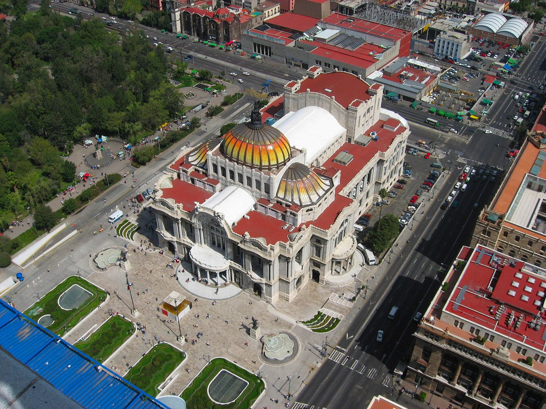
Notice how the tower marks the edge of the old colonial grid: west of here, the city opens into the Alameda.
Walk on · Cross Eje Central with the lights and walk north one block to the post office; 3 minutes.
Palacio Postal
Look at the carved stone front with its Gothic and Italian details.
The Palacio Postal, opened in 1907, is still a working post office. It was designed by the Italian architect Adamo Boari, who also began the Palacio de Bellas Artes across the street, and it mixes Venetian Gothic, Renaissance and Spanish elements in a richly carved front.
Step inside if it is open. The main hall is a forest of bronze and iron: an ornate double staircase, gilded railings, and old counters and post boxes, all built in the last years of the Porfirio Díaz government, when Mexico wanted to look modern and European.
Notice the lamps and the iron and glass ceiling, and the people still queueing for stamps among the ornament.
Walk on · Cross the street west to the white marble building with the orange domes; 2 minutes.
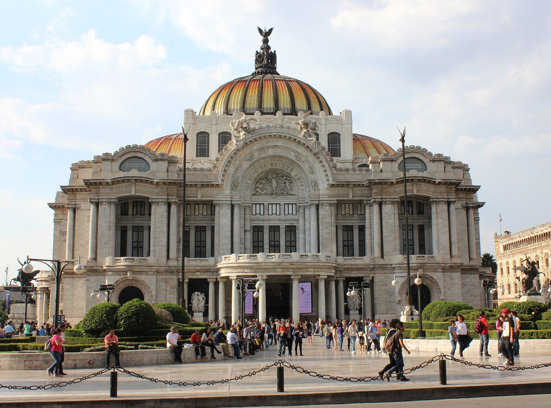
Palacio de Bellas Artes
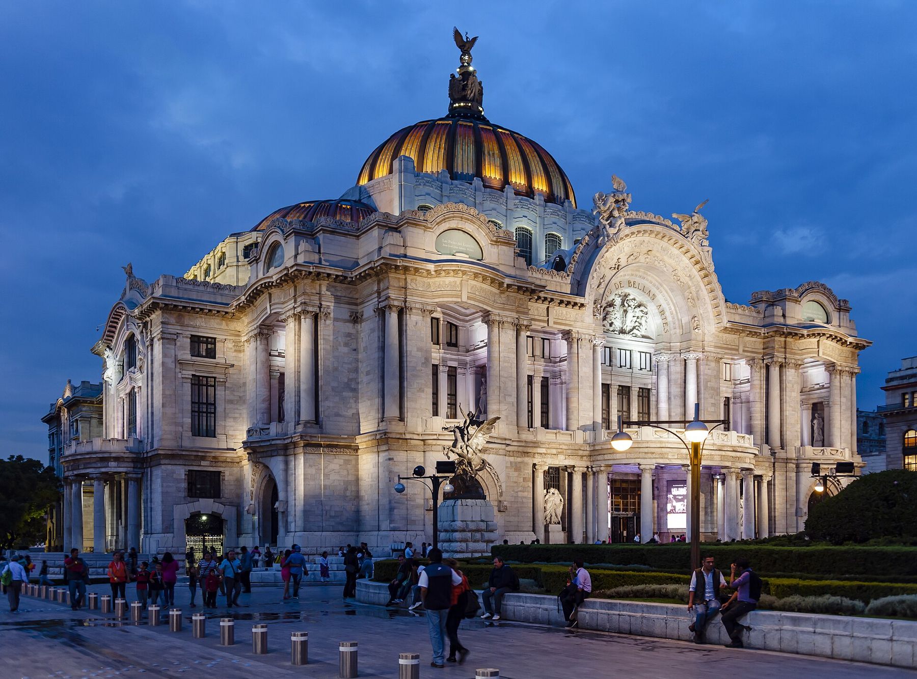
Look up at the domes and the sculpted figures across the white marble front.
The Palacio de Bellas Artes was begun in 1904 by Adamo Boari as the national theatre. Revolution, money and the soft ground stopped it for years, and it was finished in 1934 by Federico Mariscal, who gave it an art deco interior inside its art nouveau shell.
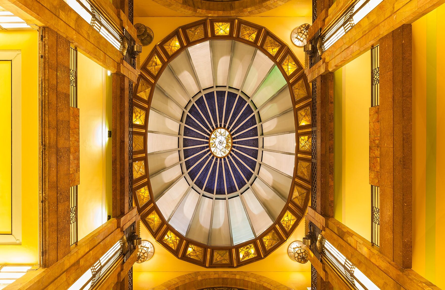
It is now the country's main stage for opera, dance and music, and its upper floors hold murals by Rivera, Orozco, Siqueiros and Tamayo. The marble building has sunk by several metres into the old lakebed since construction began.
Notice, as you walk round, how the ground around the palace slopes down toward it, and the Alameda Central park spread out to the west.
Where you finish
You end beside Bellas Artes, with the Alameda Central, the city's oldest public park, just to the west. Metro Bellas Artes is at the palace corner. For green space after the stone of the centre, the great park of Chapultepec is a short Metro ride west along Line 1 or a long walk down Paseo de la Reforma.
Crowds, shade and toilets
The centre is flat but crowded, especially on Madero from late morning and at weekends. Shade is scarce in the Zócalo and on Madero, and the sun is strong at this altitude, so wear a hat and drink water. Museums, the cathedral area and many larger buildings have toilets; some public ones charge a small fee, so carry coins.
Safety sense
Pickpockets work the crowds in the Zócalo, on Madero and in the Metro. Carry your bag in front, keep your phone in a zipped pocket, and leave valuables at your lodging. Large demonstrations sometimes fill the Zócalo and close nearby streets; if you meet one, take a parallel street. The centre empties after dark on some blocks, so finish this walk in daylight.