Belém lies about six kilometres west of the centre, where the Tagus widens before it meets the Atlantic. In the age of the great voyages this was the departure point: Vasco da Gama sailed from here for India in 1497. The kings who grew rich on that trade built their grandest monuments on this shore, and the twentieth century added its own.
The walk starts in the garden opposite the presidential palace, goes past the long front of the Jerónimos Monastery, through the formal gardens of Praça do Império and under the road to the river. It then follows the waterfront west past the Padrão dos Descobrimentos and the seaplane monument to the Belém Tower. The route is flat and takes about two hours with stops; going inside the monastery or the tower takes longer, and both charge entry with hours that change.
Tram 15 runs from Praça da Figueira and Praça do Comércio to Belém, and the Cascais line train from Cais do Sodré stops at Belém station, two minutes from the start.
Praça Afonso de Albuquerque
Look at the tall column topped by the bronze figure of Afonso de Albuquerque.
Afonso de Albuquerque was the second governor of Portuguese India and the man who seized Goa in 1510 and Malacca in 1511, building the chain of forts that controlled the spice trade for much of the sixteenth century. His monument went up at the start of the twentieth century; the reliefs around the base show scenes from his campaigns.
Across the road behind you, the pink building is the Palácio de Belém, the official residence of the president of Portugal, with guards at the gate. Look along the street to the west: the row of old houses with arcades at street level is one of the few stretches of old Belém village that survives between the monuments. Before the reclaimed land and the railway, the river came almost to this garden.
Walk on · West along Rua de Belém past the old houses to the monastery's south door, 6 minutes.
Mosteiro dos Jerónimos
Look at the carved south doorway with Henry the Navigator standing between the doors.
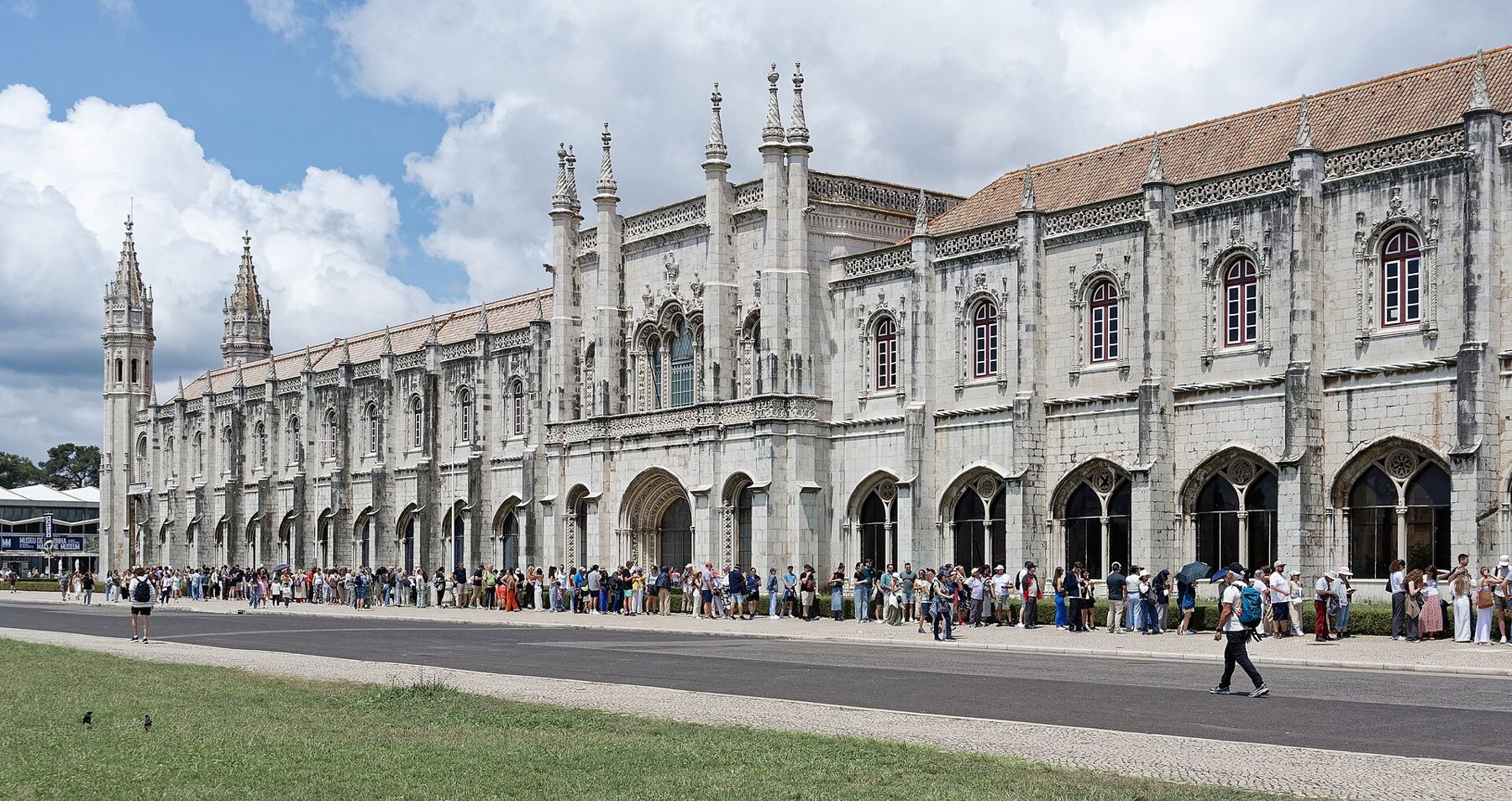
King Manuel ordered the monastery for the Hieronymite friars at the start of the sixteenth century, and paid for it in large part with a tax on the spice trade. The architects Diogo de Boitaca and then João de Castilho worked on it for decades. It is the great monument of the Manueline style, with stone carved into ropes, sea creatures, armillary spheres and the cross of the Order of Christ. It came through the 1755 earthquake with little damage.
Inside the church, the tombs of Vasco da Gama and the poet Luís de Camões stand near the entrance. The monastery and the Belém Tower were listed together as a World Heritage Site in 1983. The south doorway, facing the river, is the richest piece of carving; look for the figure of Henry the Navigator on the central pillar. The façade runs for about three hundred metres, so step back across the lawns to see it whole.
Walk on · Cross the road at the lights into the formal gardens, 2 minutes.
Praça do Império
Look at the large fountain in the centre of the hedged gardens.
These formal gardens were laid out for the Portuguese World Exhibition of 1940, held in Belém to celebrate the founding of the nation in 1140 and the restoration of independence in 1640. It was staged by the Estado Novo dictatorship as a show of empire, and much of today's Belém waterfront was shaped by it.
To the west, the large modern building of pale stone is the Centro Cultural de Belém, built in the early 1990s, now home to concert halls and an art museum. From the fountain look back at the monastery: this is the best place to see the whole length of the façade in one view. Then look south to find the underpass that takes you beneath the railway and the riverside road.
 Change here for the Lisbon lineBaixa and the river front
Walk on · South through the underpass beneath road and railway to the riverbank, 4 minutes.
Padrão dos Descobrimentos
Look at Henry the Navigator at the prow, holding a model ship.
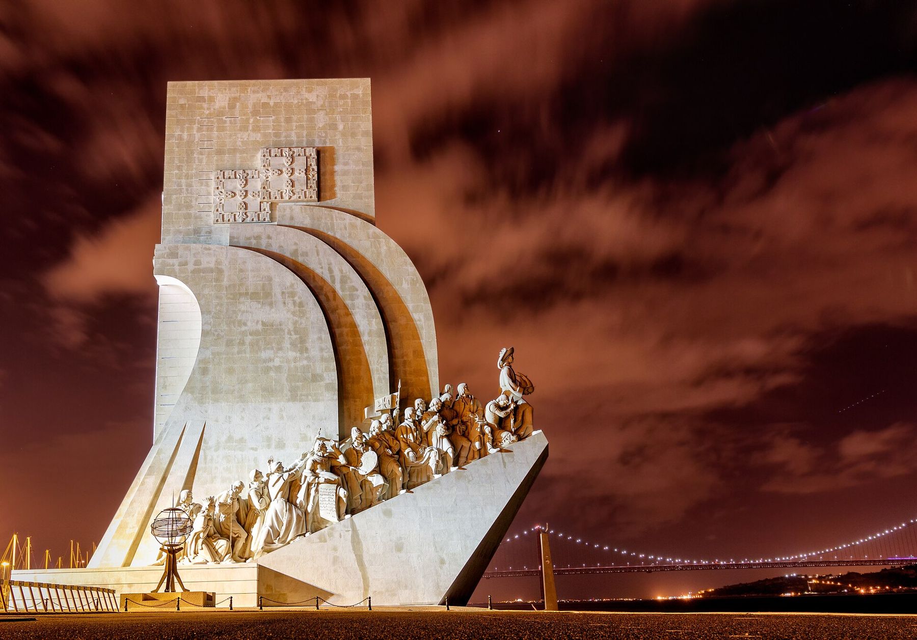
This monument to the Portuguese voyages of discovery was first built as a temporary structure for the 1940 exhibition. The permanent version, in concrete faced with stone, was unveiled in 1960 for the five hundredth anniversary of the death of Prince Henry the Navigator. It was designed by the architect José Ângelo Cottinelli Telmo and the sculptor Leopoldo de Almeida.
It takes the shape of a ship's prow, with Henry at the front and figures of navigators, kings, missionaries, cartographers and chroniclers climbing behind him on both sides. On the ground in front, a large compass rose holds a map of the world in the paving, marked with dates of Portuguese voyages. Walk across it to find the routes to Brazil and India. The monument tells the story of the voyages as the regime that built it wanted it told; the map invites a closer reading.
Walk on · West along the riverside path past the marina, 12 minutes; the river stays on your left.
Monument to the first South Atlantic flight
Look at the steel seaplane mounted on its tall pedestal by the water.
In 1922 two Portuguese naval aviators, Gago Coutinho and Sacadura Cabral, made the first aerial crossing of the South Atlantic, flying from Lisbon to Rio de Janeiro in a series of hops in seaplanes. They used navigation instruments of Coutinho's own design and had to change aircraft on the way after accidents at sea.
The monument is a replica of one of their seaplanes, and stands on the riverbank close to the point where the flight began. It is a newer addition to a waterfront of much older monuments, and an apt one: four centuries after the caravels, Portuguese navigators were again crossing an ocean from this shore. From here you can see the tower ahead, standing at the water's edge.
Walk on · Continue west along the river through the lawns to the tower, 4 minutes.
Torre de Belém
Look for the carved stone rhinoceros head under a turret on the west side.
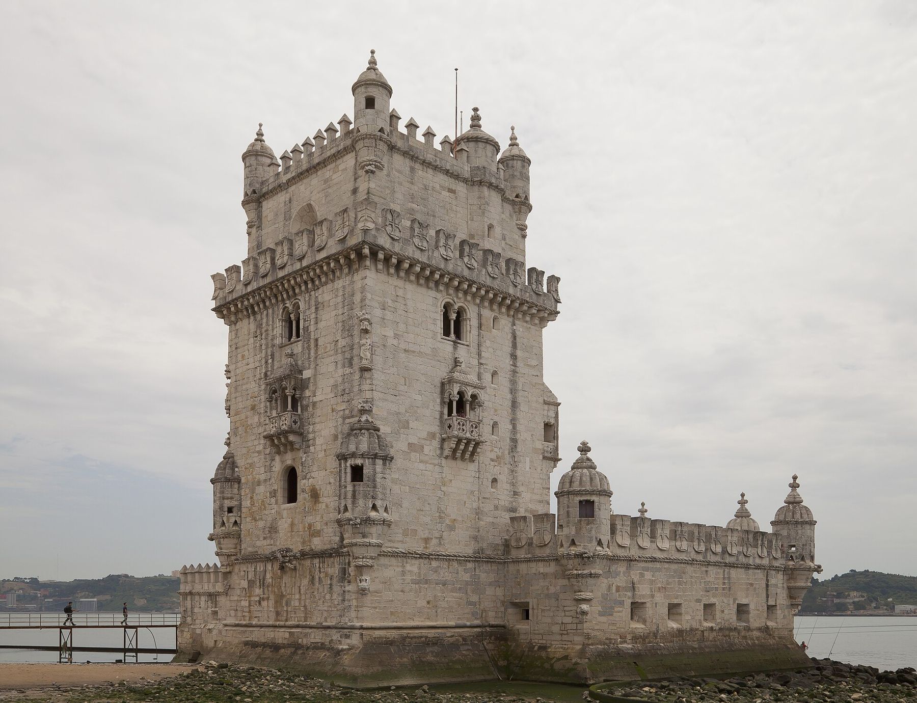
The tower was built in the 1510s, in the reign of King Manuel, to defend the mouth of the river and to greet the ships coming home. The architect was Francisco de Arruda. It once stood out in the river on a rock; changes in the shoreline over the centuries have brought the bank up to it. The tower later served as a customs post, a lighthouse and a prison.
The carving mixes defence with display: battlements shaped like shields with the cross of the Order of Christ, balconies in the Venetian style and watchtowers with ribbed domes. Look for the rhinoceros, a reminder of the live rhinoceros sent from India to King Manuel in 1515. Entry is ticketed, the stairs are narrow and one-way at times, and the queue can be long.
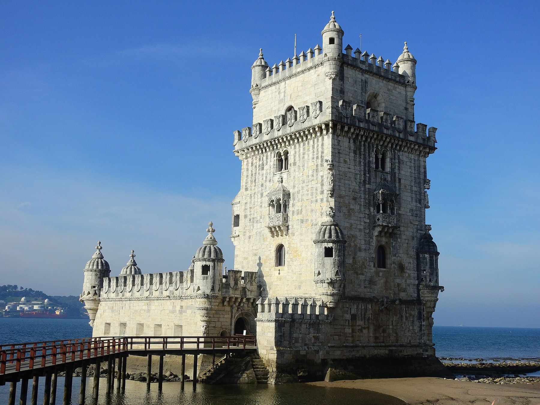
Finishing at the tower
The walk ends at the Belém Tower. To return to the centre, cross the footbridge over the railway to the main road and walk back east to the tram 15 stops, or use Belém station on the Cascais line. The lawns around the tower are a good place to sit and watch the ships before you go.
Shade, water and crowds
The riverfront is broad and almost entirely open to the sun and wind, so take a hat and water, and a layer for the breeze off the river even in summer. The only real shade is in the gardens of Praça do Império and under the trees near the monastery. There are public toilets near the monastery and the Padrão; check before you set off along the river. Belém is one of the busiest places in Lisbon; go early on a weekday, and keep an eye on your bag in queues and on the crowded tram.
Next
Back in the centre, the Baixa walk shows the city rebuilt after 1755, and the Alfama walk climbs to the castle the first king took in 1147.