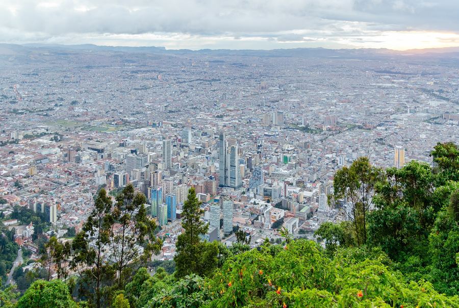
La Candelaria is the oldest part of Bogotá: a grid of steep streets climbing toward the Eastern Hills, lined with low colonial houses, tiled roofs and painted walls, and holding some of the country's most important cultural buildings. Students fill it on weekdays, and the street art changes from month to month.
This walk starts at the top, at the small square where the city traditionally places its founding in 1538, and works downhill and west past the church that gave the district its name, the national library of the central bank, the Museo Botero, a cultural centre by Rogelio Salmona and the Teatro Colón. It ends at the Jesuit church of San Ignacio, a block from Plaza de Bolívar.
The route is about 1.3 kilometres and takes around an hour and a half at an easy pace, longer if you go inside the museums. Walking downhill matters here: the city sits at roughly 2,600 metres, and the streets rise steadily toward the hills, so starting at the top saves your lungs.
The nearest TransMilenio stop is Museo del Oro, on Avenida Jiménez. From there the Chorro de Quevedo is a steady uphill walk of about fifteen minutes, so many visitors take a taxi to Calle 12B with Carrera 2 and begin fresh.
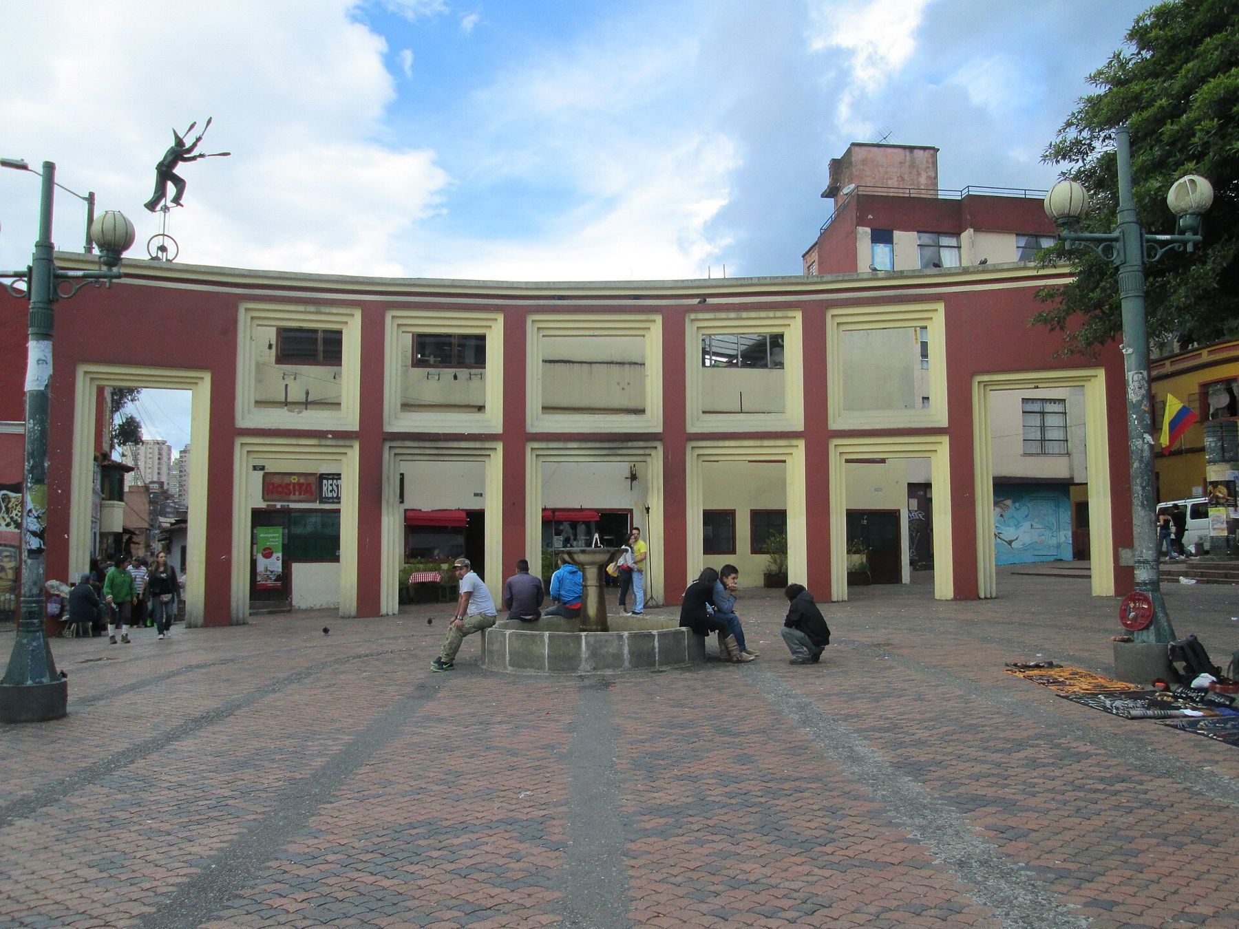
Plaza del Chorro de Quevedo
Look at the round stone fountain in the middle of the small square.
This little square is where Bogotá traditionally places its beginning. In August 1538 the conquistador Gonzalo Jiménez de Quesada is said to have founded the city near here, on land of the Muisca people. Historians still argue about the exact spot, but the tradition is old and the square keeps it.
The name comes from water: a chorro is a spout, and for a long time a public spring here supplied the neighbourhood. The man named Quevedo who gave it his name is usually described as a priest. The fountain you see now is a later reconstruction.
Notice who uses the square. Several universities sit a few blocks away, and in the afternoons students, street performers and storytellers gather on the steps and benches.
Walk on · Leave by the narrow lane opening off the square's northern side; 1 minute.
Calle del Embudo
Look along the lane and watch it pinch in like a funnel.
Embudo means funnel, and the name describes the shape: the lane is wide at one end and squeezed at the other, with low whitewashed houses leaning in on both sides. It is one of the narrowest and oldest-looking corners of the district.
The lane is known for chicha, the fermented maize drink with Muisca roots that was for decades restricted by law in Bogotá and has come back in places like this. The walls are covered in murals and tags, and La Candelaria is one of the places where the city's street art is densest. Artists paint over each other, so what you see will not match any photograph.
Notice the doorways: many are low and set in thick adobe walls, the way colonial houses were built against cold and earthquakes.
Walk on · Head downhill and west about 350 metres, toward Calle 11; 7 minutes.
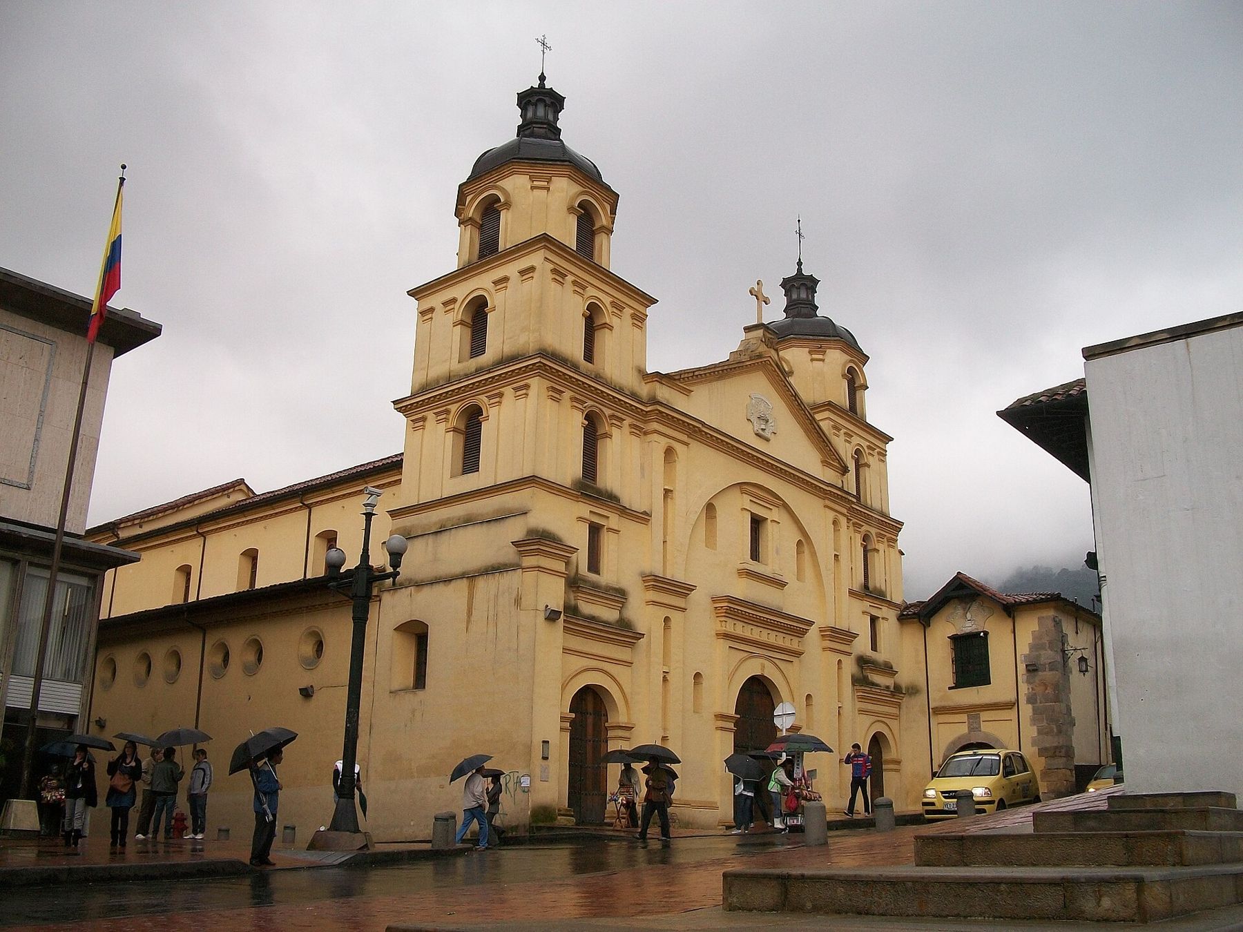
Iglesia de La Candelaria
Look up at the two bell towers above the ochre front.
This is the church that gave the district its name. It is dedicated to the Virgin of La Candelaria and was built in the colonial period by Augustinian friars, with later changes to the front. Inside, colonial paintings hang along the nave, and the church is still a working parish.
While you are here, learn the address system, because it makes the rest of Bogotá easy. The church stands at Calle 11 # 3-86: it is on Calle 11, the nearest cross street is Carrera 3, and the door is 86 metres from that corner. Every address in the city works this way.
Look east, past the towers, on a clear morning and you see the green wall of the hills with the white church of Monserrate on its crest.
Walk on · Continue west along Calle 11 for one block; the library is on your right. 2 minutes.
Biblioteca Luis Ángel Arango
Look at the long modern front and the steady stream of students.
The Biblioteca Luis Ángel Arango opened in 1958 and is run by the Banco de la República, Colombia's central bank, which also runs the Museo del Oro and the museums across the street. It is named after a former head of the bank, and it is one of the most used public libraries in Latin America.
The building has grown in stages around the original block, and it also holds a concert hall known for chamber music. On a weekday the reading rooms are full, a reminder that this old quarter is still very much a student district.
Notice how the bank's buildings face each other across Calle 11: the library on one side and a cluster of museums on the other, all connected to the same institution.
Walk on · Cross Calle 11 to the arched doorway almost opposite; 1 minute.
Museo Botero and Casa de Moneda
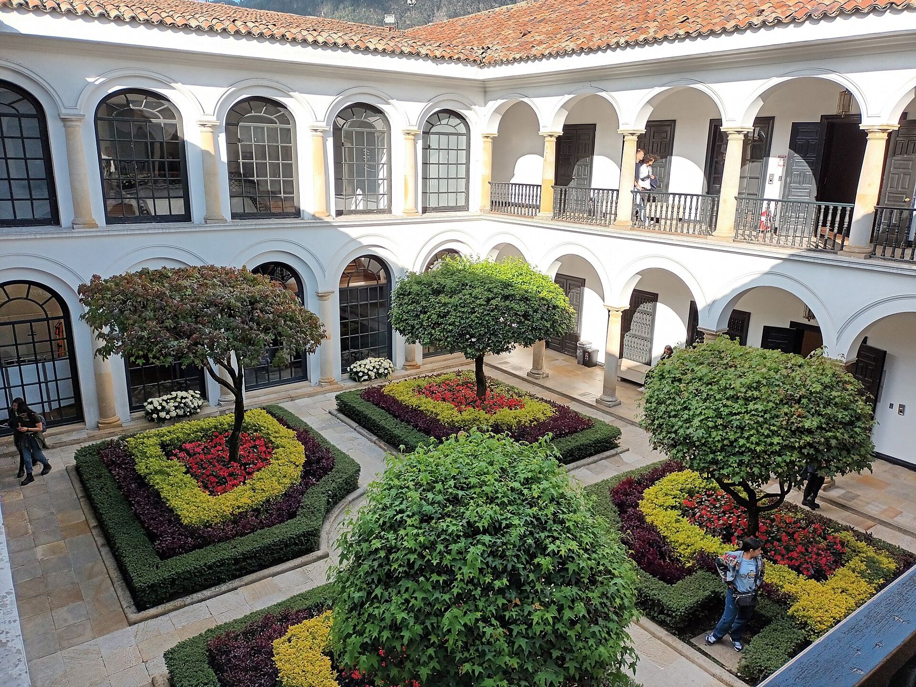
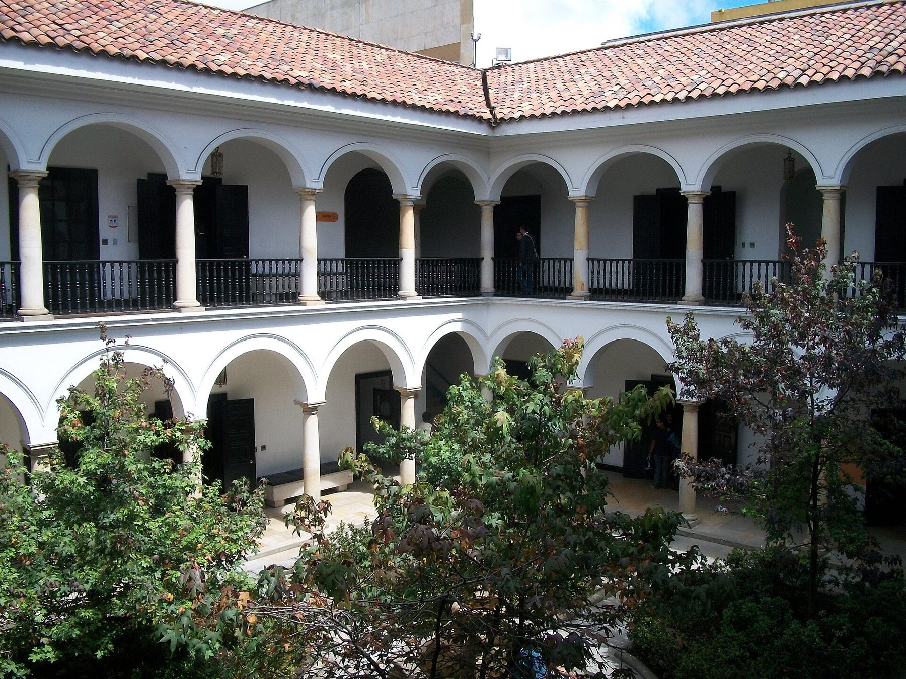
Look through the doorway into the arcaded patio and its clipped trees.
The painter and sculptor Fernando Botero, born in Medellín, gave a large collection to the Banco de la República in 2000: works of his own, with their famously rounded figures, and paintings by European artists he had bought. The museum fills a colonial house built around two floors of white arcades.
The house connects through to the Casa de Moneda next door, the colonial mint. Coins were struck in Bogotá from the early seventeenth century, and the present mint building dates from the eighteenth. Its rooms now tell the story of Colombian money.
Notice the stillness of the patios after the street, and the way the arcades frame the hills above the roofs.
 Change here for the Bogotá lineUp Monserrate
Walk on · Continue west on Calle 11 to the brick building at the next corner; 3 minutes.
Centro Cultural Gabriel García Márquez
Look at the curving brick walls and the round open courtyard.
This cultural centre was designed by Rogelio Salmona, the best known Colombian architect of the twentieth century, and opened in 2008, the year after his death. It was built by the Fondo de Cultura Económica, Mexico's state publishing house, and named after the Colombian novelist who won the Nobel Prize in 1982.
Salmona worked almost always in red brick, and this building is a compact lesson in his style: ramps instead of stairs, narrow water channels, and courtyards open to the sky. The public can walk through it.
Climb the ramps and you get one of the best views of the district: a field of tiled roofs, the domes and towers of the colonial churches, and the hills behind.
Walk on · Walk one block south to Calle 10; the theatre stands a few steps away. 3 minutes.
Teatro Colón
Look up at the columns and carved figures across the theatre's pale front.
The Teatro Colón opened in 1892 and is named after Christopher Columbus, whose first voyage reached the Americas four hundred years earlier. It was designed by the Italian architect Pietro Cantini, and its horseshoe auditorium follows the European opera houses of the time. It was restored in the 2010s and remains one of the country's main stages.
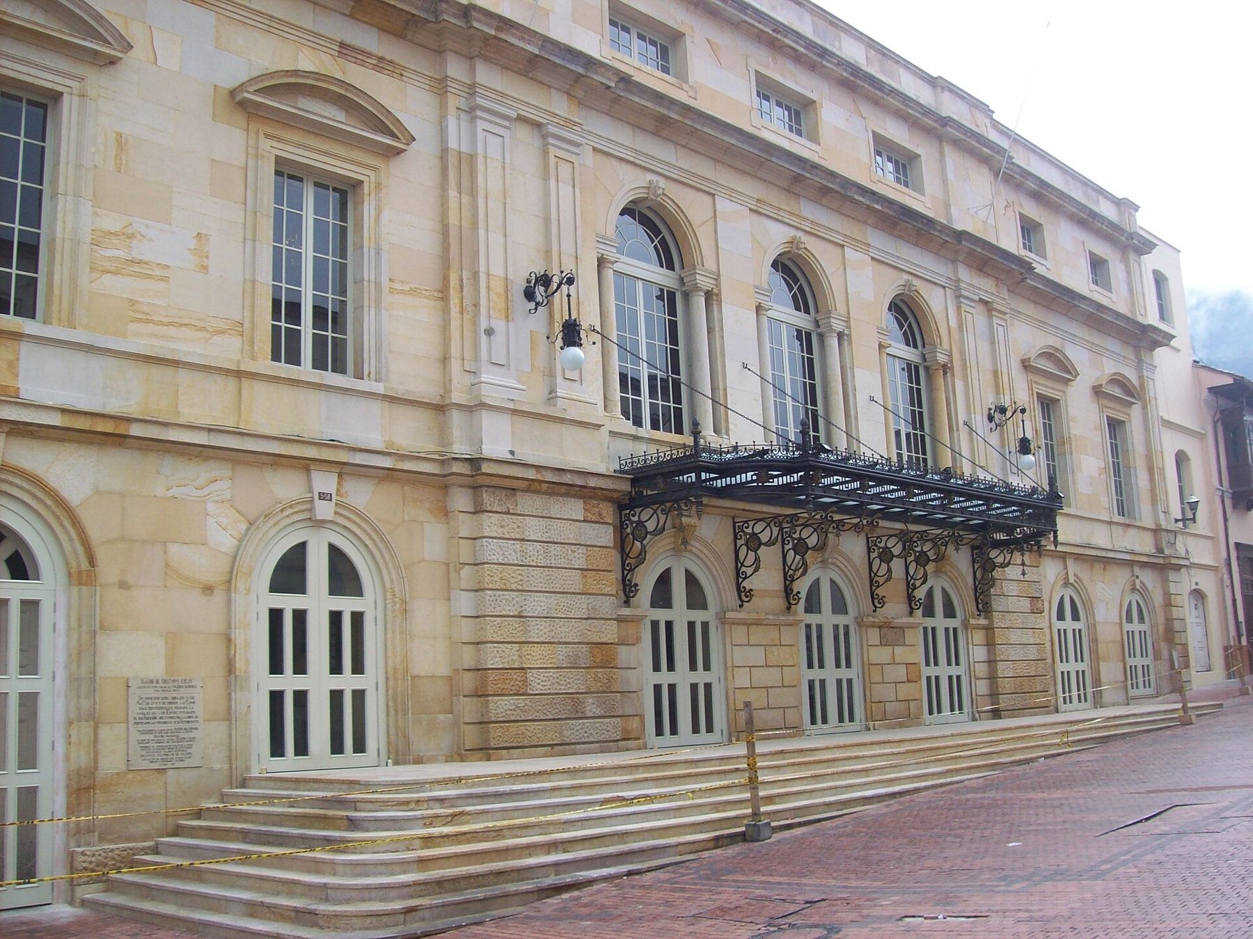
Across the street stands the Palacio de San Carlos, now the Foreign Ministry. On the night of 25 September 1828 conspirators broke in to kill Simón Bolívar, who was living there as president. He escaped by jumping from a window, helped by Manuela Sáenz. Look for the inscription beside the window on the outside wall.
Walk on · Continue west along Calle 10 to the large stone church on the corner; 2 minutes.
Iglesia de San Ignacio
Look at the heavy stone front and the long plain wall of the nave.
San Ignacio was the church of the Jesuits, begun in the early seventeenth century, and it is one of the largest colonial churches in the city. The Jesuits ran a college next door, and the building where they taught now holds the Museo Colonial, with paintings, sculpture and furniture from the centuries of Spanish rule.
The Spanish crown expelled the Jesuits from its territories in 1767, and their properties here passed to other uses, from schools to government offices.
Notice the change of scale since the start of the walk. Up at the Chorro the houses were single storeys of adobe; down here, a few hundred metres away, the stone church and the public buildings around it announce that you have reached the centre of power. Plaza de Bolívar is one block west and north.
Where you finish
You end on Calle 10 beside San Ignacio. Plaza de Bolívar, with the cathedral and the Capitolio, is a block away, so this walk joins naturally with the next one on the line. For a different side of the city, the brick houses of Chapinero are a short taxi ride north.
Pace, weather and footing
The whole route runs downhill, but the streets are steep in places and the stone and brick surfaces turn slippery when it rains, which in Bogotá is often in the afternoon. Wear shoes with grip and carry a light rain layer. Pavements are narrow and uneven, so look down as often as up.
There is little shade and little need for it: the air is cool, but the sun at this altitude burns quickly. Carry water. Museums and the cultural centres on the route have toilets for visitors.
Safety sense
La Candelaria is busy by day and much quieter after dark. Walk it in daylight, keep your phone and camera out of sight when you are not using them, and carry only what you need. Colombians have a saying for this, no dar papaya: do not make yourself an easy target. For the trip back, use a registered taxi or a ride-hailing app rather than hailing a car on a quiet street.