Chapinero was once a village on the road north of Bogotá. In 1884 the city's first tram line, pulled by mules, connected it with the centre, and over the following decades wealthy families built country houses and then whole neighbourhoods here. Today it is a dense, mixed district of offices, universities, flats and nightlife, and it holds some of the best brick architecture in the city.
This walk starts in the Parque de los Hippies on Carrera Séptima, crosses to the Lourdes church on Chapinero's old square, then heads north into Quinta Camacho, a small area of English-style brick houses from the 1930s and 1940s. It ends east of the Séptima in the Zona G, a few leafy blocks at the foot of the hills.
The route is about 2.1 kilometres and takes around an hour and a half. It is mostly flat, with a gentle rise toward the hills at the end.
Carrera Séptima carries buses north from the centre and from La Candelaria; ask for Calle 60. A taxi or ride-hailing car to Carrera 7 with Calle 60 is the simplest way to arrive.
Parque de los Hippies
Look at the trees, benches and paths of the small square park.
This small park beside Carrera Séptima is formally named after Antonio José de Sucre, one of Bolívar's generals, but everyone calls it the Parque de los Hippies. In the late 1960s and 1970s it was a meeting place for the young counterculture of Bogotá, and the nickname stuck.
It is still a meeting point: students, office workers on a break, street vendors and people waiting for friends. The Séptima, the city's long north-south spine, runs past its edge.
Notice the buildings around it: red brick almost everywhere, from low houses to towers. Brick made from the clay of the Sabana is Bogotá's signature material, and Chapinero shows it at every scale.
Walk on · Walk north and west about 450 metres to Calle 63; the church spire guides you. 7 minutes.
Iglesia de Nuestra Señora de Lourdes
Look up at the pointed arches and the spire of the grey stone church.
The church of Our Lady of Lourdes is Chapinero's landmark, a neo-Gothic church of grey stone with pointed arches, pinnacles and a tall central spire. It was begun in 1875, when Chapinero was still a separate village, and took decades to finish.
The square in front, the Plaza de Lourdes, was the centre of that village. Today it is a busy public space with buses, vendors and people crossing between the shopping streets around it.
Notice the stonework on the front and the rose window above the main door: in a city of brick, a stone church of this size was a statement of ambition for a suburb that was only beginning to grow. Step inside, quietly, to see the long nave and stained glass.
Walk on · Head north-east through the streets to Calle 67, then on to Quinta Camacho; 9 minutes.
Quinta Camacho
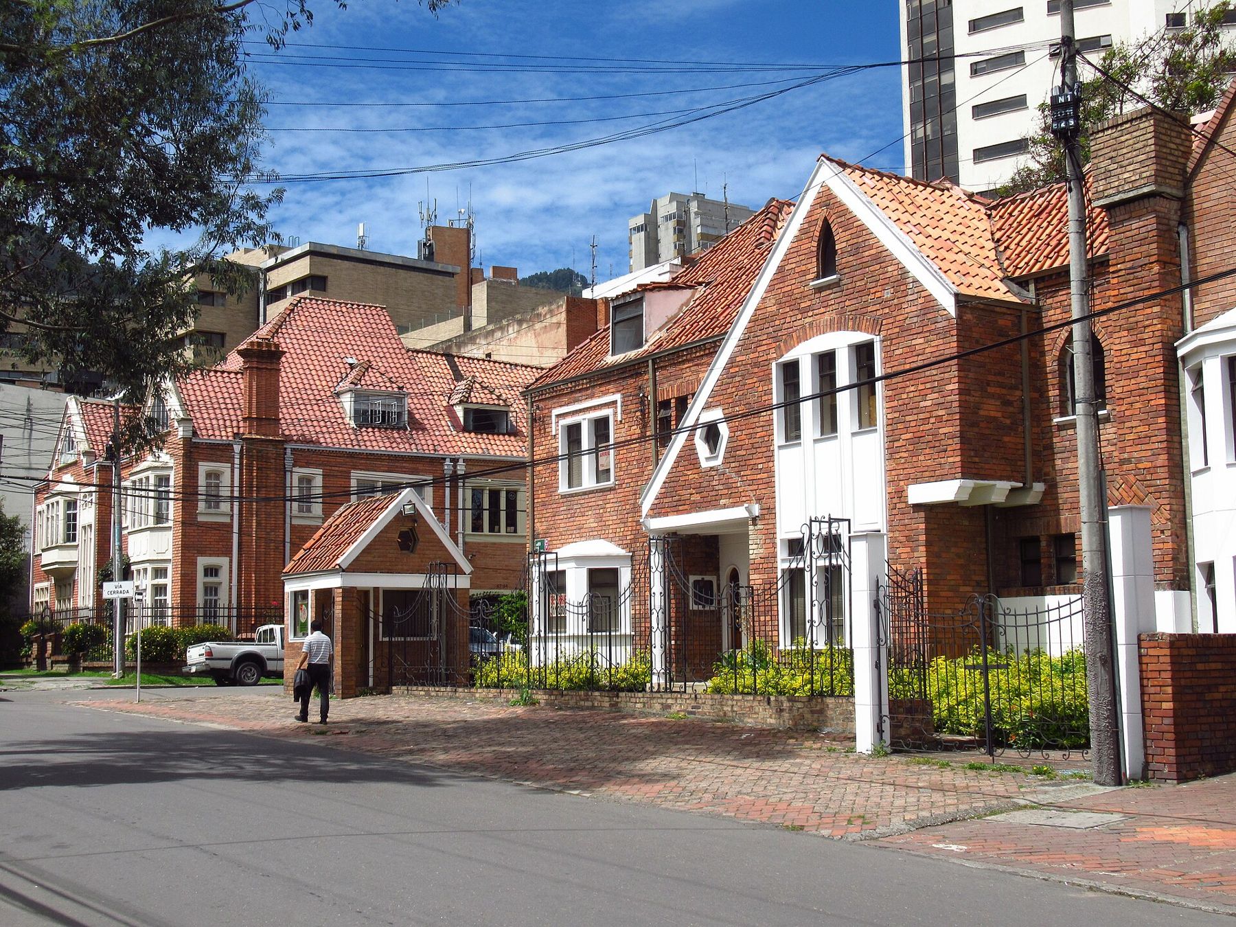
Look at the steep tiled roofs, tall chimneys and bay windows of the houses.
Quinta Camacho takes its name from a country estate, a quinta, owned by the Camacho family, which was divided into building lots in the 1930s. The new owners, mostly well-off Bogotá families, built in an English style that was fashionable at the time: red brick, steep roofs, gables, bay windows and small front gardens.
The area is protected for its architecture. Many of the houses are now offices, galleries, restaurants and studios, but the street fronts have kept their character.
Notice the details: brick laid in patterns around windows, carved stone door frames, iron railings and the small grassy front gardens. This is a neighbourhood to walk slowly and look at, block by block.
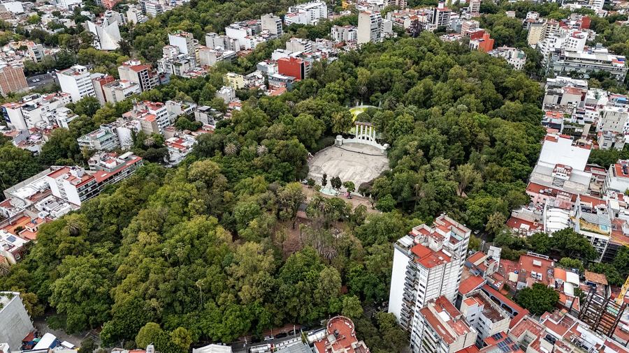 Change here for the Mexico City lineRoma and Condesa
Walk on · Walk east along Calle 69 toward Carrera 8; 4 minutes.
Calle 69 toward Carrera 8
Look along the row of brick houses with gables, chimneys and iron gates.
This stretch of Calle 69 shows Quinta Camacho at its most complete: a row of brick houses with steep tiled roofs, pointed gables and white-framed windows behind low walls and iron gates.
Modern towers stand directly behind some of them. As land values rose, many old houses in Chapinero were pulled down for apartment blocks; the protection of Quinta Camacho came after much had already gone, which is why you see the old and the new pressed together.
Notice the paving: the sidewalks here are often laid in brick too, matching the houses.
Walk on · Continue north-east to Calle 71 near Carrera Séptima; 5 minutes.
Calle 71 at Carrera Séptima
Look at the stone-fronted house with the portico of columns.
Near the corner of Calle 71 and Carrera Séptima stand two houses that show how varied the style here became. One is a pale stone house with a slate roof and dormer windows, closer to a French townhouse. The other, a few steps away, is a red-brick house with a classical portico, used for many years by a religious order.
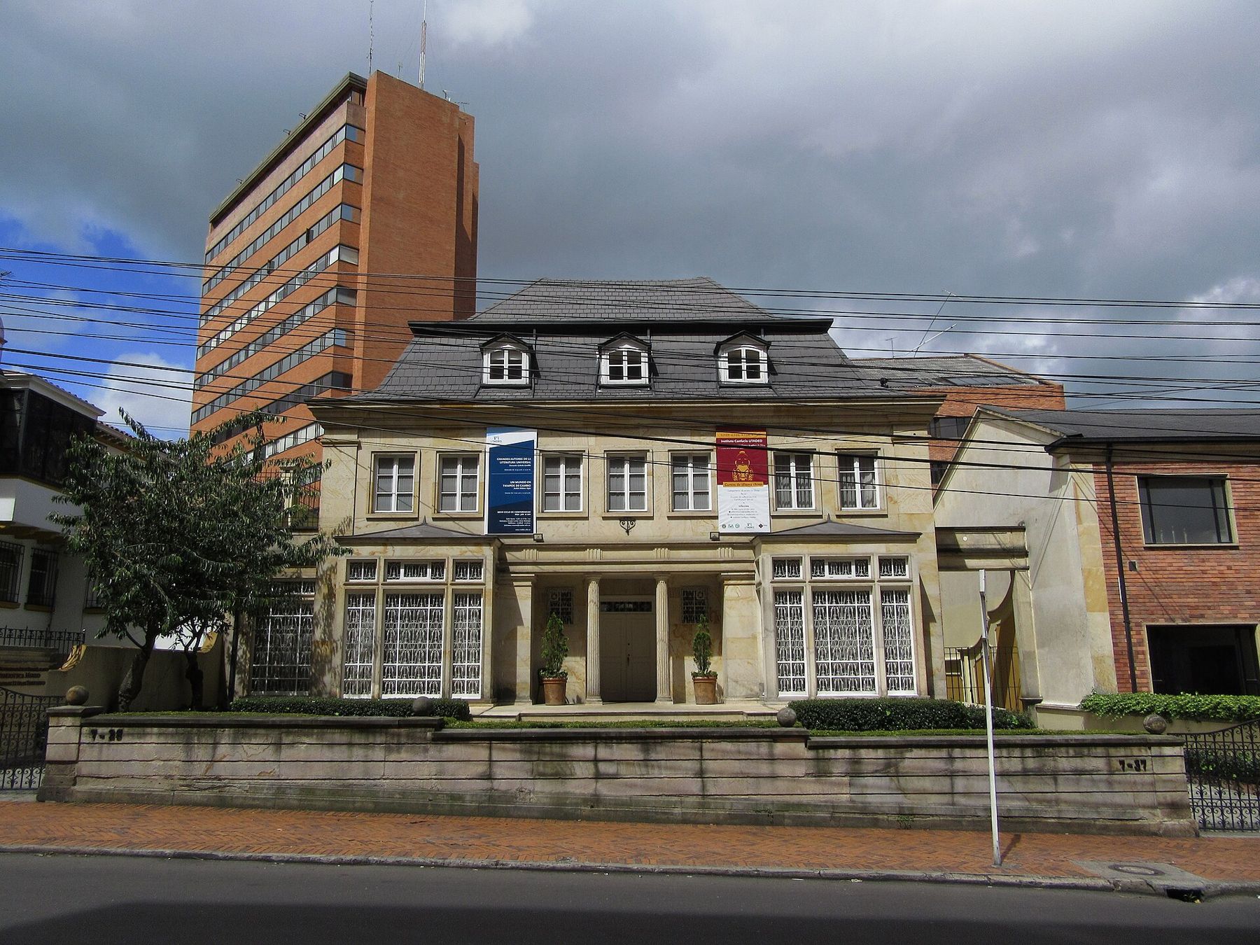
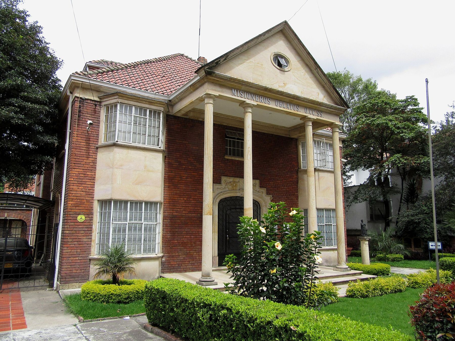
Families who built here in the 1930s and 1940s looked to Europe for their models, and architects mixed English, French and classical ideas freely.
Notice the traffic of the Séptima a few metres away: the quiet streets begin as soon as you turn the corner.
Walk on · Cross Carrera Séptima with care and walk two blocks east to Calle 70; 5 minutes.
Zona G, Calle 70
Look at the low brick houses and the trees along the quiet street.
The few blocks between the Séptima and the hills, roughly from Calle 69 to Calle 70, are known as the Zona G. The G stands for gourmet: since the 1990s many of the houses here have become restaurants, and the area is one of the city's best known for eating out.
By day, outside meal times, it is a calm residential corner of brick houses, trees and front gardens, with the slope of the hills beginning just to the east.
Notice how the streets start to climb and curve here. The regular grid of carreras and calles loosens as it meets the mountain, and many streets end in steps or footpaths.
Walk on · Walk a block south and east to Calle 69A, toward the hills; 3 minutes.
Calle 69A below the hills
Look east at the forested hills rising above the last houses.
Calle 69A takes you to the edge of the Zona G, where the city meets the slope of the Eastern Hills. Above the last rows of brick flats the forest climbs steeply, often with cloud resting on the ridge.
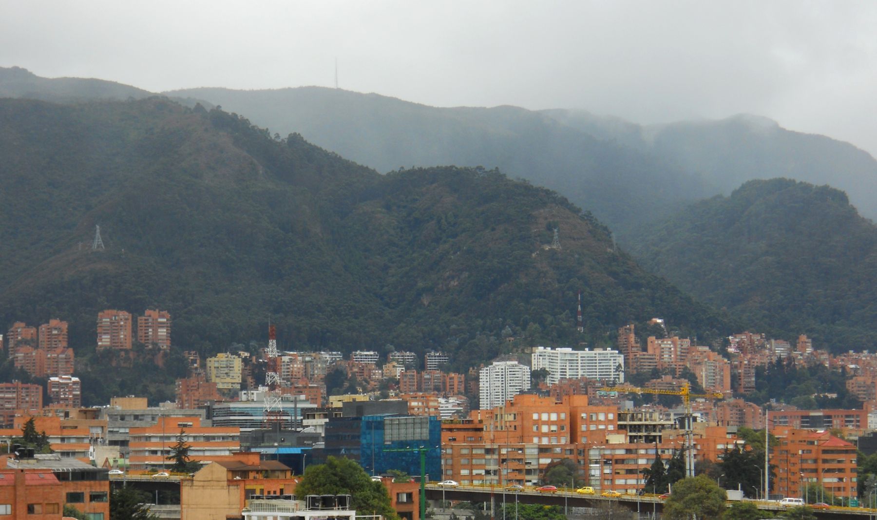
From this edge you can understand the layout of the whole city: the hills to the east, always, and the grid running away from them toward the west, with the numbers of the calles climbing as you go north.
Notice how the brick of the buildings matches the colour of the soil on the slopes: much of it was made from the same earth.
Where you finish
You end at the eastern edge of the Zona G. Walk back down to Carrera Séptima for buses and taxis. If you want more of northern Bogotá, Usaquén is a short ride north along the Séptima and is best on a Sunday.
Footing, shade and toilets
The walk is mostly flat on sidewalks, but sidewalks in Chapinero can be broken, high-kerbed and interrupted by driveways, so watch your step, especially in rain. There is some shade under street trees in Quinta Camacho and the Zona G. Public toilets are scarce; cafés and shopping centres are the practical option. Carry water and a rain layer.
Safety sense
Chapinero is a busy, ordinary city district. The area around the Plaza de Lourdes is crowded and attracts pickpockets, so keep valuables out of sight there. Quinta Camacho and the Zona G are calm by day and lively in the evening around meal times. Cross Carrera Séptima only at lights, and use a registered taxi or a ride-hailing app at night.